MyTopo
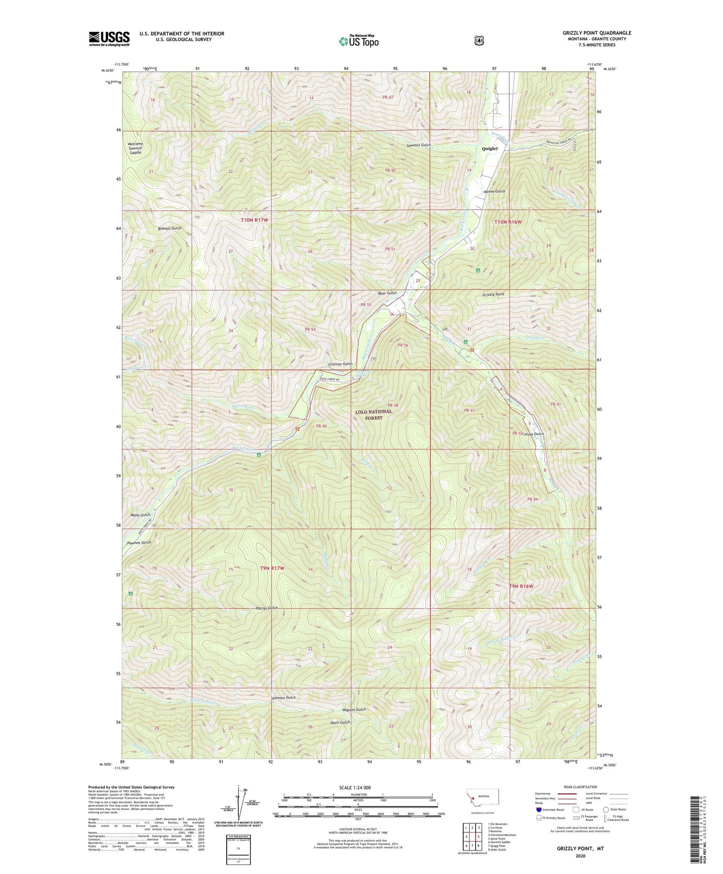
Grizzly Point Montana US Topo Map
Couldn't load pickup availability
Also explore the Grizzly Point Forest Service Topo of this same quad for updated USFS data
2024 topographic map quadrangle Grizzly Point in the state of Montana. Scale: 1:24000. Based on the newly updated USGS 7.5' US Topo map series, this map is in the following counties: Granite. The map contains contour data, water features, and other items you are used to seeing on USGS maps, but also has updated roads and other features. This is the next generation of topographic maps. Printed on high-quality waterproof paper with UV fade-resistant inks.
Quads adjacent to this one:
West: Cleveland Mountain
Northwest: Elk Mountain
North: Iris Point
Northeast: Ravenna
East: Spink Point
Southeast: Alder Gulch
South: Quigg Peak
Southwest: Sawmill Saddle
This map covers the same area as the classic USGS quad with code o46113e6.
Contains the following named places: Ammon Gulch, Bear Gulch, Bobcat Creek, Brewster Creek, Butte Cabin Ridge Trail, Cinnabar Creek, Colusa Gulch, Dalles Campground, Dalles Creek, Elkhorn Creek, Fourth of July Creek, Gratton Gulch, Grizzly Campground, Grizzly Creek, Grizzly Point, Gunbarrel Spring, Hamm Gulch, Norton Campground, Oasis Gulch, Quigley, Quigley Post Office, Quigley School, Ranch Creek, Sawmill Creek, Sawmill Gulch, Sawmill Sportsmans Access, Waho Gulch, Wapato Gulch, Welcome Creek, Welcome Creek Campground, Welcome Creek Fishing Access Site, Welcome Creek Wilderness, Welcome Sawmill Saddle, West Fork Ranch Creek, ZIP Code: 59825