MyTopo
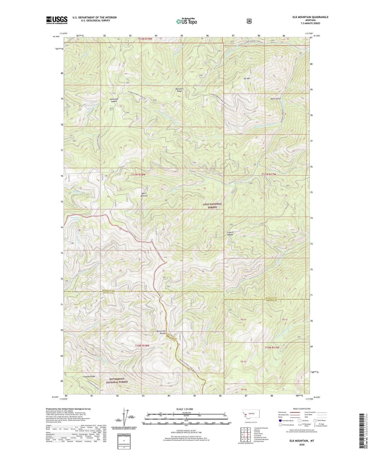
Elk Mountain Montana US Topo Map
Couldn't load pickup availability
Also explore the Elk Mountain Forest Service Topo of this same quad for updated USFS data
2024 topographic map quadrangle Elk Mountain in the state of Montana. Scale: 1:24000. Based on the newly updated USGS 7.5' US Topo map series, this map is in the following counties: Missoula, Granite, Ravalli. The map contains contour data, water features, and other items you are used to seeing on USGS maps, but also has updated roads and other features. This is the next generation of topographic maps. Printed on high-quality waterproof paper with UV fade-resistant inks.
Quads adjacent to this one:
West: Davis Point
Northwest: Southeast Missoula
North: Bonner
Northeast: Clinton
East: Iris Point
Southeast: Grizzly Point
South: Cleveland Mountain
Southwest: Grayhorse Creek
This map covers the same area as the classic USGS quad with code o46113f7.
Contains the following named places: Eightmile Saddle, Elk Mountain, Holloman Saddle, Last Drink Creek, Last Drink Springs, Middle Fork Swartz Creek, Moccasin Ridge, North Fork Eightmile Creek, S and G Saddle, Teton Gulch, Two Y Junction, West Fork Swartz Creek, Yukon Saddle