MyTopo
Grant Montana US Topo Map
Couldn't load pickup availability
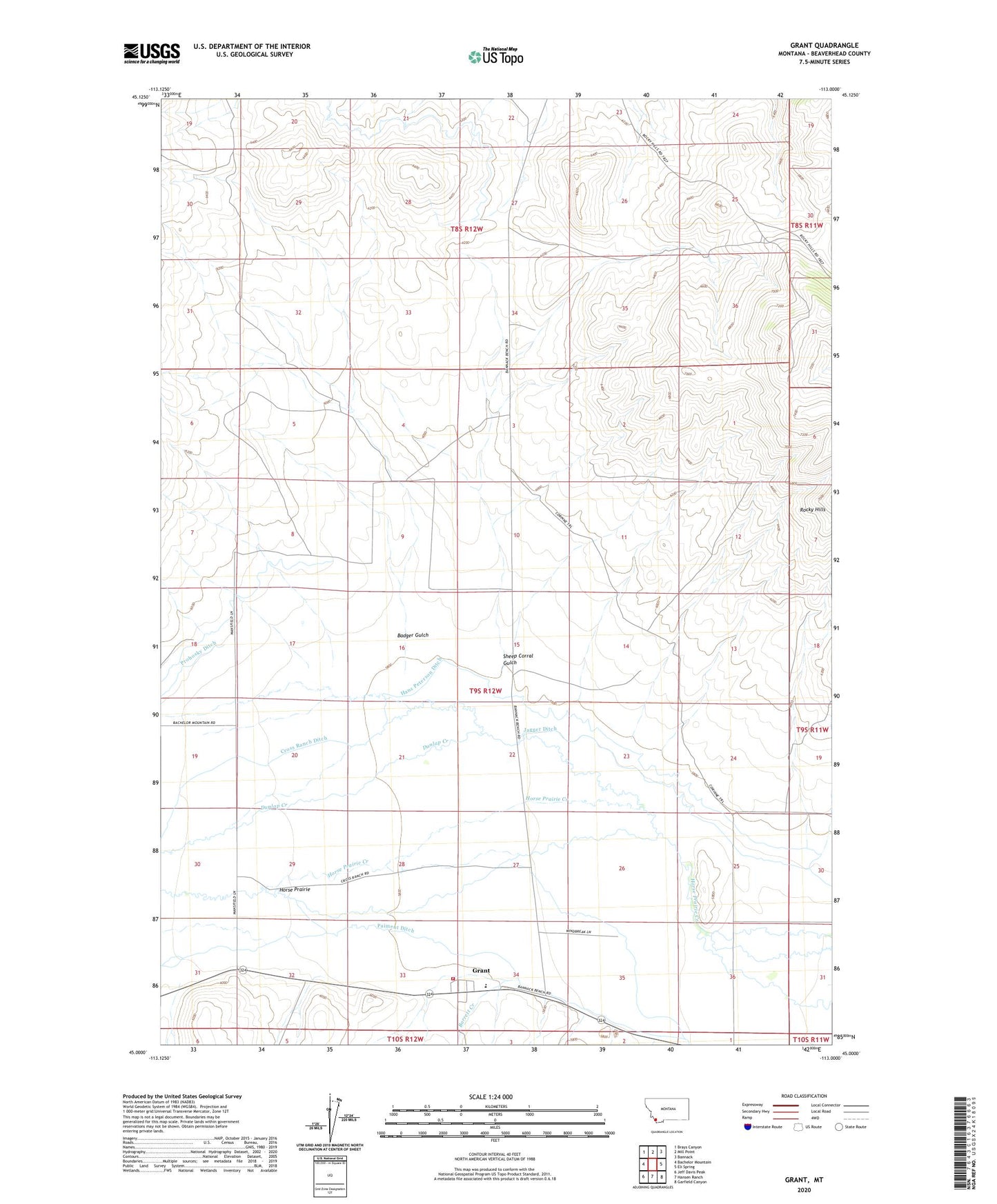
2024 topographic map quadrangle Grant in the state of Montana. Scale: 1:24000. Based on the newly updated USGS 7.5' US Topo map series, this map is in the following counties: Beaverhead. The map contains contour data, water features, and other items you are used to seeing on USGS maps, but also has updated roads and other features. This is the next generation of topographic maps. Printed on high-quality waterproof paper with UV fade-resistant inks.
Quads adjacent to this one:
West: Bachelor Mountain
Northwest: Brays Canyon
North: Mill Point
Northeast: Bannack
East: Eli Spring
Southeast: Garfield Canyon
South: Hansen Ranch
Southwest: Jeff Davis Peak
This map covers the same area as the classic USGS quad with code o45113a1.
Contains the following named places: 08S12W32CDDD01 Well, 09S12W03BDAC01 Well, 09S12W08ACDA01 Well, 09S12W11BBDD01 Well, 09S12W13ACBD01 Well, 09S12W14ACAD01 Well, 09S12W18DDAD01 Well, 09S12W18DDAD02 Well, 09S12W22DCBB01 Well, 09S12W22DCBD01 Well, 09S12W22DCBD02 Well, 09S12W29CBBB01 Well, 09S12W33DAAA01 Well, 09S12W34CBAB01 Well, Amesville Post Office, Badger Gulch, Bannack Bench Windmill, Bannock Bench Well, Barrett Creek, Cross Ranch, Cross Ranch Ditch, Dunlap Creek, Grant, Grant Census Designated Place, Grant Fire Department, Grant Post Office, Grant School, Hans Peterson Ditch, Horse Prairie, Jagger Ditch, Knox Station, Paiment Ditch, Rocky Well, Rocky Windmill, Sheep Corral Gulch