MyTopo
Jump Off Peak Montana US Topo Map
Couldn't load pickup availability
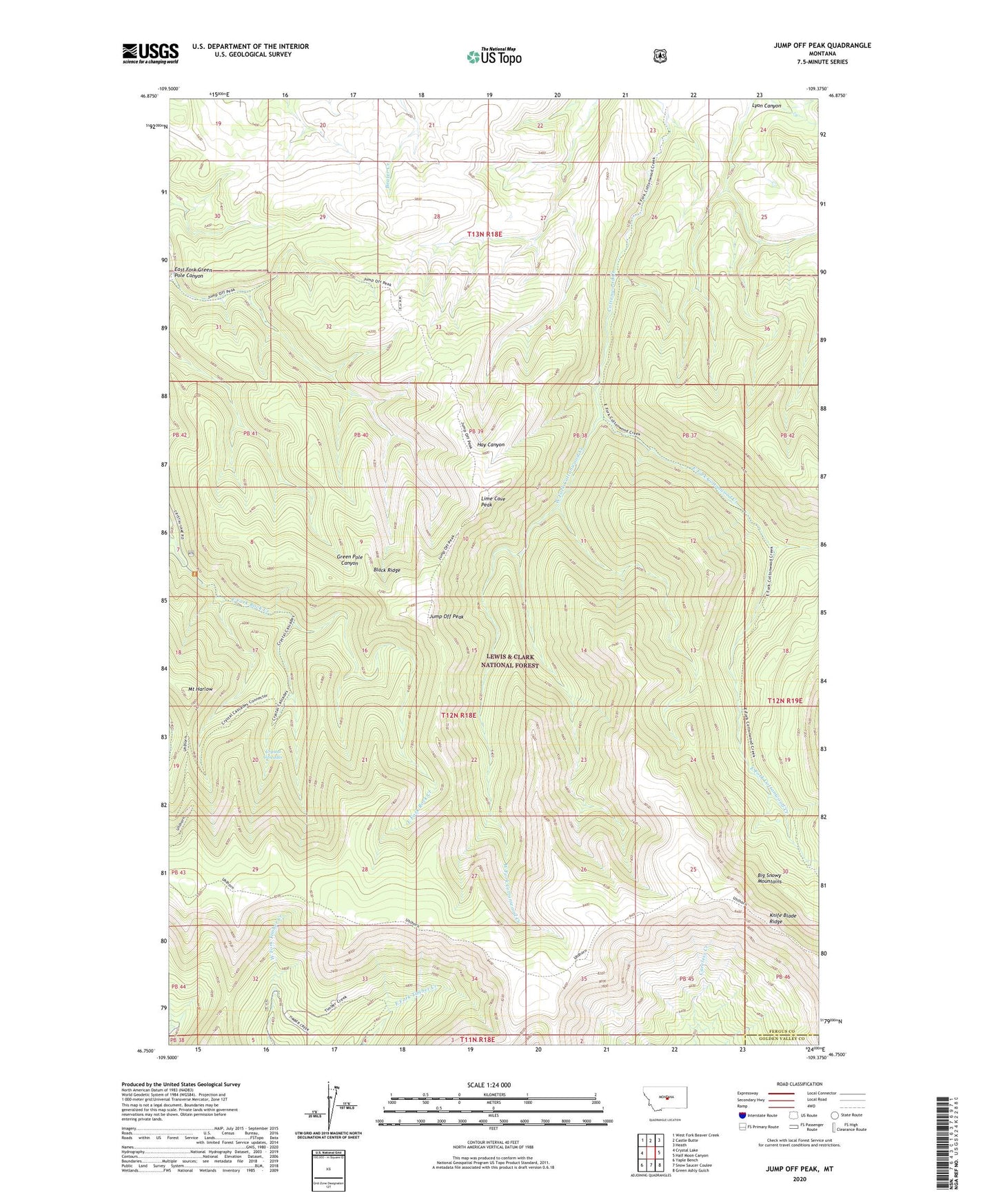
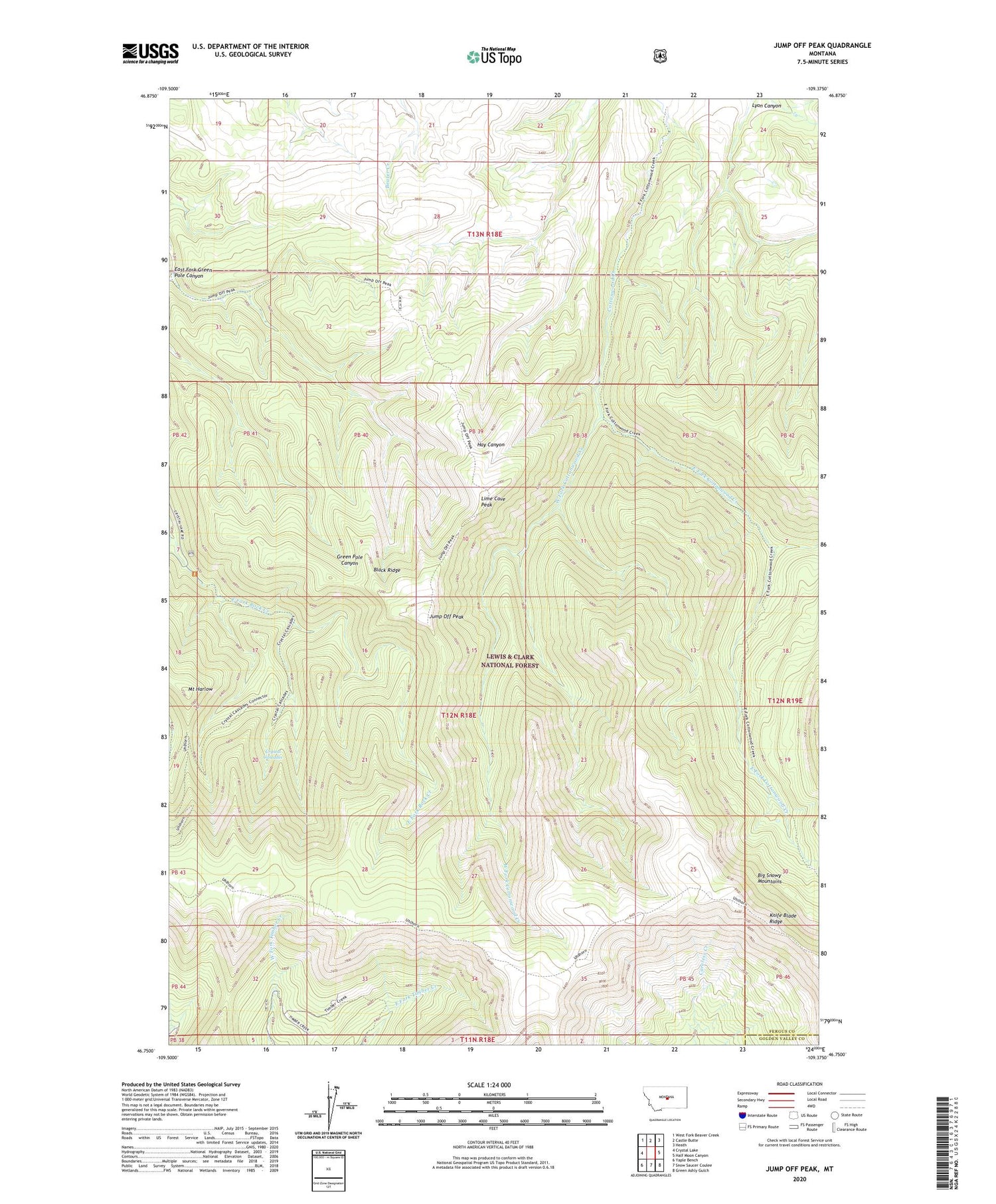
2020 topographic map quadrangle Jump Off Peak in the state of Montana. Scale: 1:24000. Based on the newly updated USGS 7.5' US Topo map series, this map is in the following counties: Fergus, Golden Valley. The map contains contour data, water features, and other items you are used to seeing on USGS maps, but also has updated roads and other features. This is the next generation of topographic maps. Printed on high-quality waterproof paper with UV fade-resistant inks.
Quads adjacent to this one:
West: Crystal Lake
Northwest: West Fork Beaver Creek
North: Castle Butte
Northeast: Heath
East: Half Moon Canyon
Southeast: Green Ashly Gulch
South: Snow Saucer Coulee
Southwest: Yaple Bench
Contains the following named places: Big Snowy Mountains, Black Ridge, Crystal Cascades, East Fork Cottonwood Creek, East Fork Green Pole Canyon, East Fork Rock Creek, Jump Off Peak, Knife Blade Ridge, Lime Cave Peak, Mount Harlow, West Fork Cottonwood Creek