MyTopo
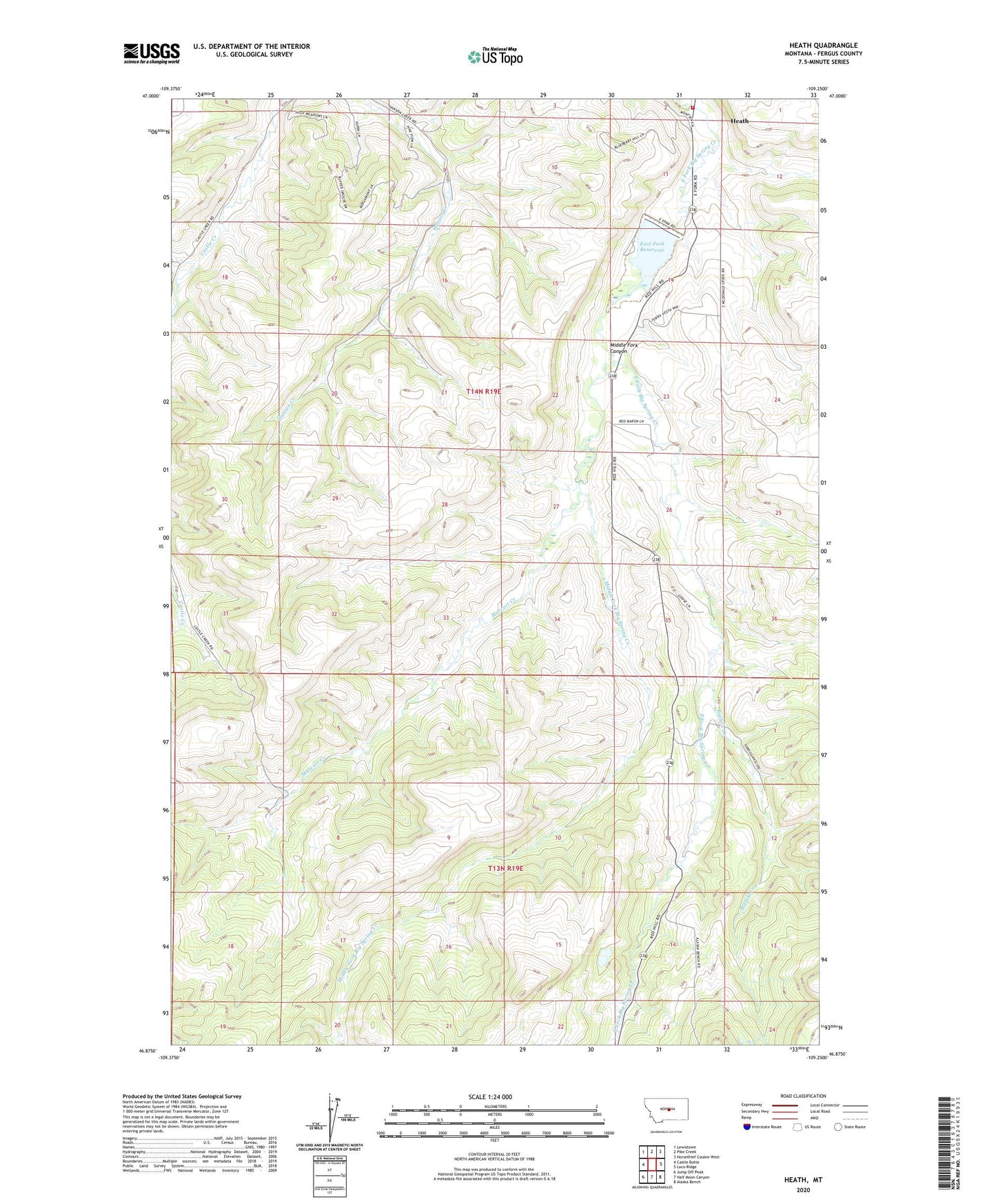
Heath Montana US Topo Map
Couldn't load pickup availability
Also explore the Heath Forest Service Topo of this same quad for updated USFS data
2024 topographic map quadrangle Heath in the state of Montana. Scale: 1:24000. Based on the newly updated USGS 7.5' US Topo map series, this map is in the following counties: Fergus. The map contains contour data, water features, and other items you are used to seeing on USGS maps, but also has updated roads and other features. This is the next generation of topographic maps. Printed on high-quality waterproof paper with UV fade-resistant inks.
Quads adjacent to this one:
West: Castle Butte
Northwest: Lewistown
North: Pike Creek
Northeast: Horsethief Coulee West
East: Loco Ridge
Southeast: Alaska Bench
South: Half Moon Canyon
Southwest: Jump Off Peak
This map covers the same area as the classic USGS quad with code o46109h3.
Contains the following named places: 14N19E13CCB_01 Well, 14N19E23BBA_01 Well, 14N19E23CCD_01 Well, Alger Post Office, Bear Paw School, Bowman School, Buffalo Creek, Castle Creek School, East Fork Dam, East Fork Reservoir, Hanson Creek Dam, Heath, Heath Post Office, Heath Rural Fire District, Marcott Creek, Middle Fork Big Spring Creek, Middle Fork Canyon, Mountain View School, Nelson School, Rogers School, Schumachers, Spring Branch