MyTopo
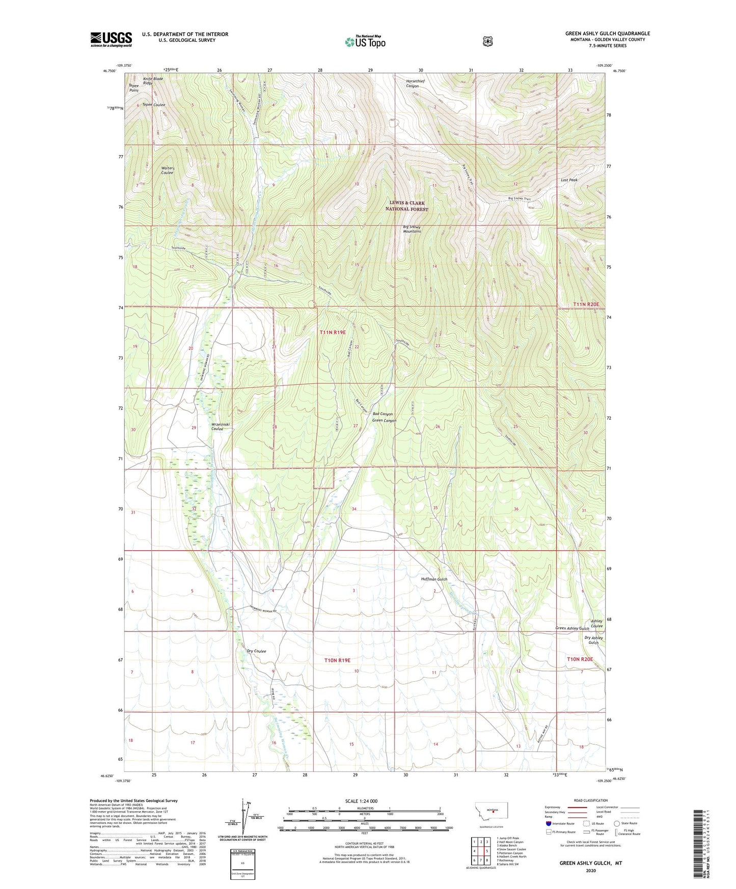
Green Ashly Gulch Montana US Topo Map
Couldn't load pickup availability
Also explore the Green Ashly Gulch Forest Service Topo of this same quad for updated USFS data
2024 topographic map quadrangle Green Ashly Gulch in the state of Montana. Scale: 1:24000. Based on the newly updated USGS 7.5' US Topo map series, this map is in the following counties: Golden Valley. The map contains contour data, water features, and other items you are used to seeing on USGS maps, but also has updated roads and other features. This is the next generation of topographic maps. Printed on high-quality waterproof paper with UV fade-resistant inks.
Quads adjacent to this one:
West: Snow Saucer Coulee
Northwest: Jump Off Peak
North: Half Moon Canyon
Northeast: Alaska Bench
East: Patterson Canyon
Southeast: Sahara Hill SW
South: Rothiemay
Southwest: Halbert Creek North
This map covers the same area as the classic USGS quad with code o46109f3.
Contains the following named places: Allen Ranch, Bad Canyon, Dry Ashley Gulch, Dry Coulee, Green Ashley Gulch, Green Canyon, Huffman Gulch, Irene Post Office, Irene School, Lost Peak, Seepy Spring Coulee, Tepee Point, Whelan Post Office, Wrzesinski Coulee