MyTopo
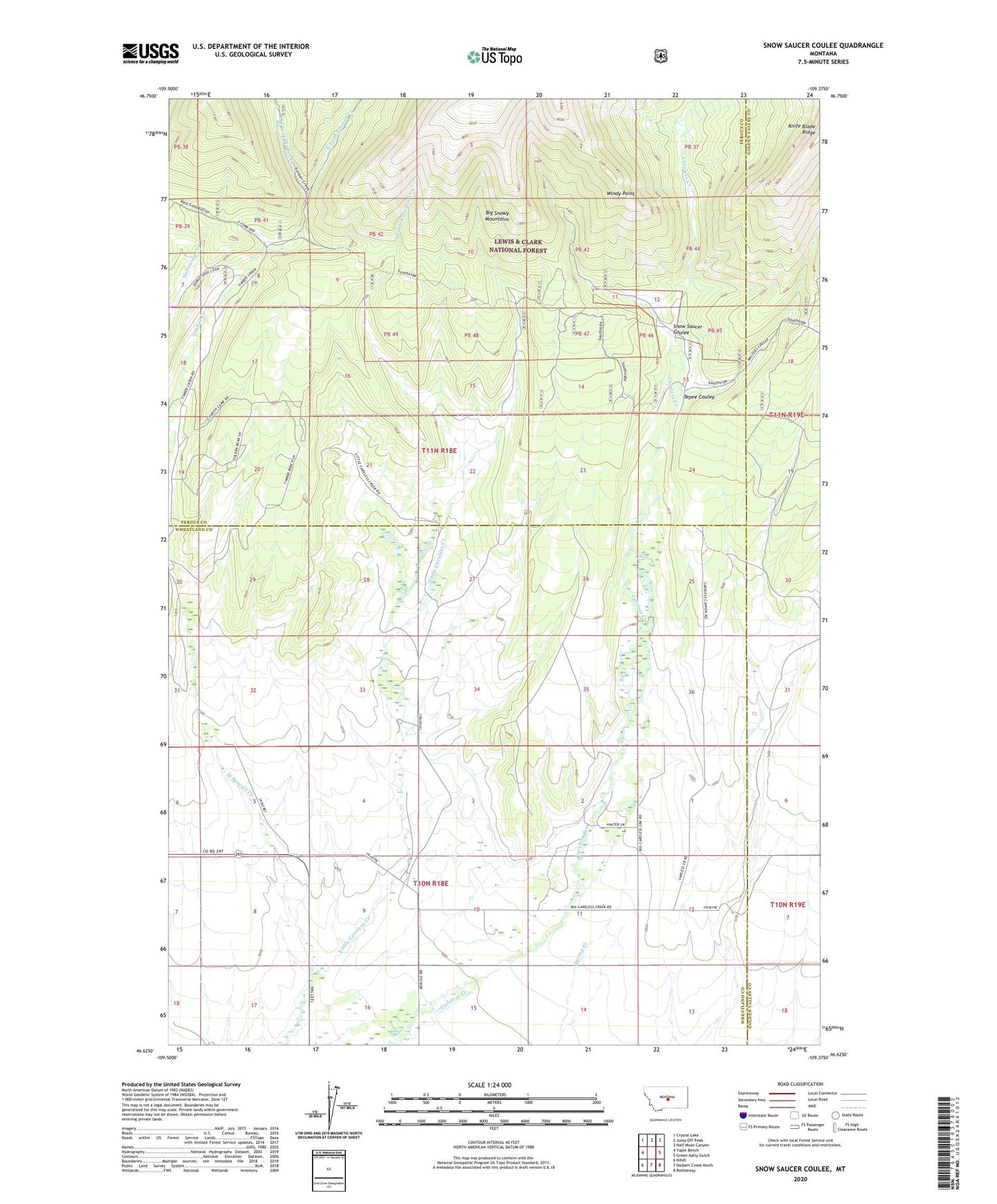
Snow Saucer Coulee Montana US Topo Map
Couldn't load pickup availability
Also explore the Snow Saucer Coulee Forest Service Topo of this same quad for updated USFS data
2024 topographic map quadrangle Snow Saucer Coulee in the state of Montana. Scale: 1:24000. Based on the newly updated USGS 7.5' US Topo map series, this map is in the following counties: Wheatland, Fergus, Golden Valley. The map contains contour data, water features, and other items you are used to seeing on USGS maps, but also has updated roads and other features. This is the next generation of topographic maps. Printed on high-quality waterproof paper with UV fade-resistant inks.
Quads adjacent to this one:
West: Yaple Bench
Northwest: Crystal Lake
North: Jump Off Peak
Northeast: Half Moon Canyon
East: Green Ashly Gulch
Southeast: Rothiemay
South: Halbert Creek North
Southwest: Nihill
This map covers the same area as the classic USGS quad with code o46109f4.
Contains the following named places: 10N18E09____01 Well, 11N18E33____01 Well, Bercail, Bercail Post Office, Bercail School, East Fork Timber Creek, Halfmoon Pass Post Office, Long Post Office, Snow Saucer Coulee, Tepee Coulee, West Bercail Creek, West Fork Timber Creek, Windy Point