MyTopo
Kenilworth NE Montana US Topo Map
Couldn't load pickup availability
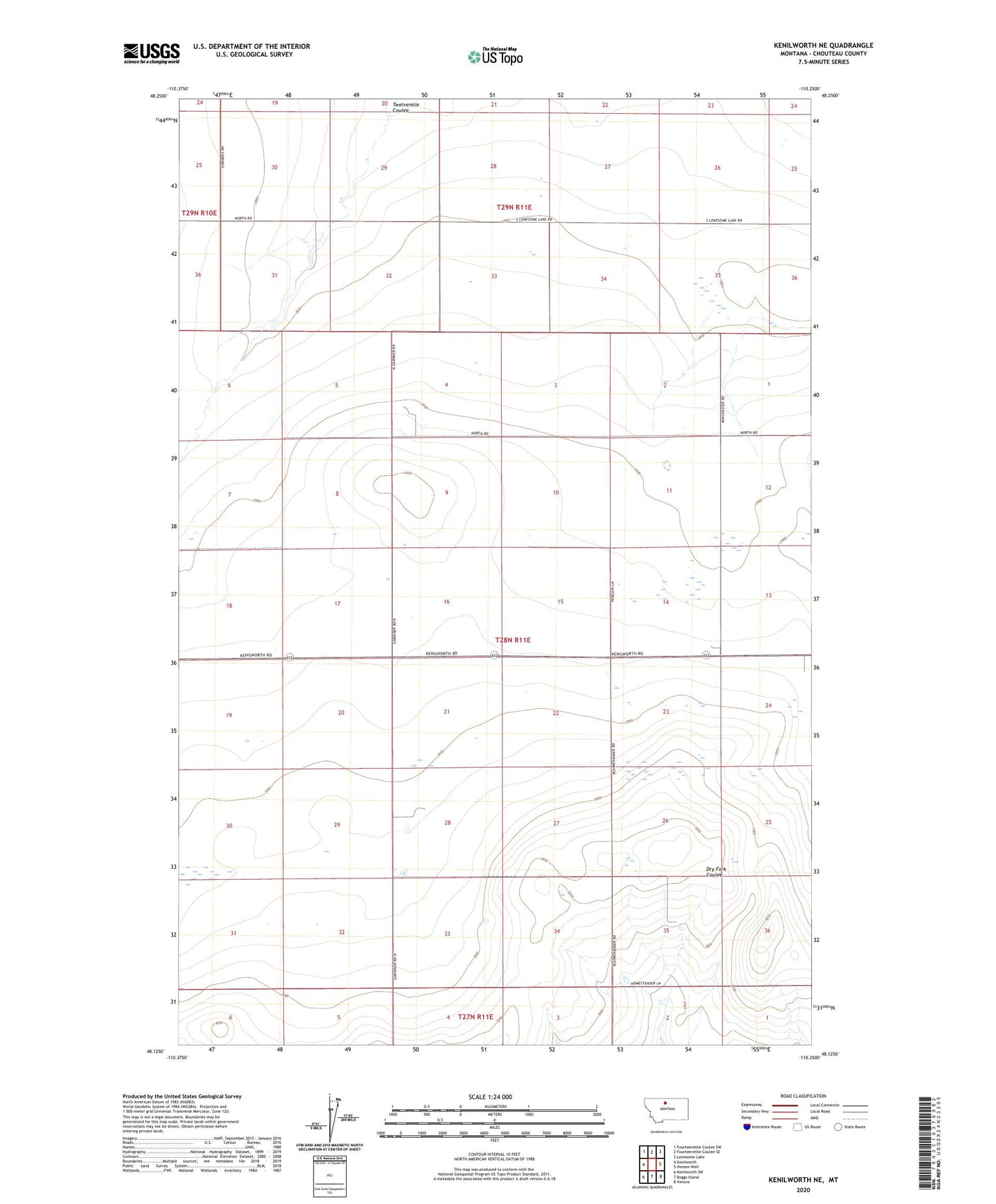
2024 topographic map quadrangle Kenilworth NE in the state of Montana. Scale: 1:24000. Based on the newly updated USGS 7.5' US Topo map series, this map is in the following counties: Chouteau. The map contains contour data, water features, and other items you are used to seeing on USGS maps, but also has updated roads and other features. This is the next generation of topographic maps. Printed on high-quality waterproof paper with UV fade-resistant inks.
Quads adjacent to this one:
West: Kenilworth
Northwest: Fourteenmile Coulee SW
North: Fourteenmile Coulee SE
Northeast: Lonesome Lake
East: Ihmsen Well
Southeast: Verona
South: Boggs Island
Southwest: Kenilworth SW
This map covers the same area as the classic USGS quad with code o48110b3.
Contains the following named places: 28N11E02AB__01 Well, 28N11E03CD__01 Well, 28N11E06AB__01 Well, 28N11E06DD__01 Well, 28N11E06DDDA01 Well, 28N11E10CC__01 Well, 28N11E12AD__01 Well, 28N11E14DD__01 Well, 28N11E15CD__01 Well, 28N11E18CC__01 Well, 28N11E19CD__01 Well, 28N11E22ACCC01 Well, 28N11E22BB__01 Well, 28N11E22BCAD01 Well, 29N10E36DD__01 Well, 29N11E29CA__01 Well, 29N11E32BB__01 Well, 29N11E35CA__01 Well, 29N11E36CD__01 Well, Lonesome Prairie