MyTopo
Ihmsen Well Montana US Topo Map
Couldn't load pickup availability
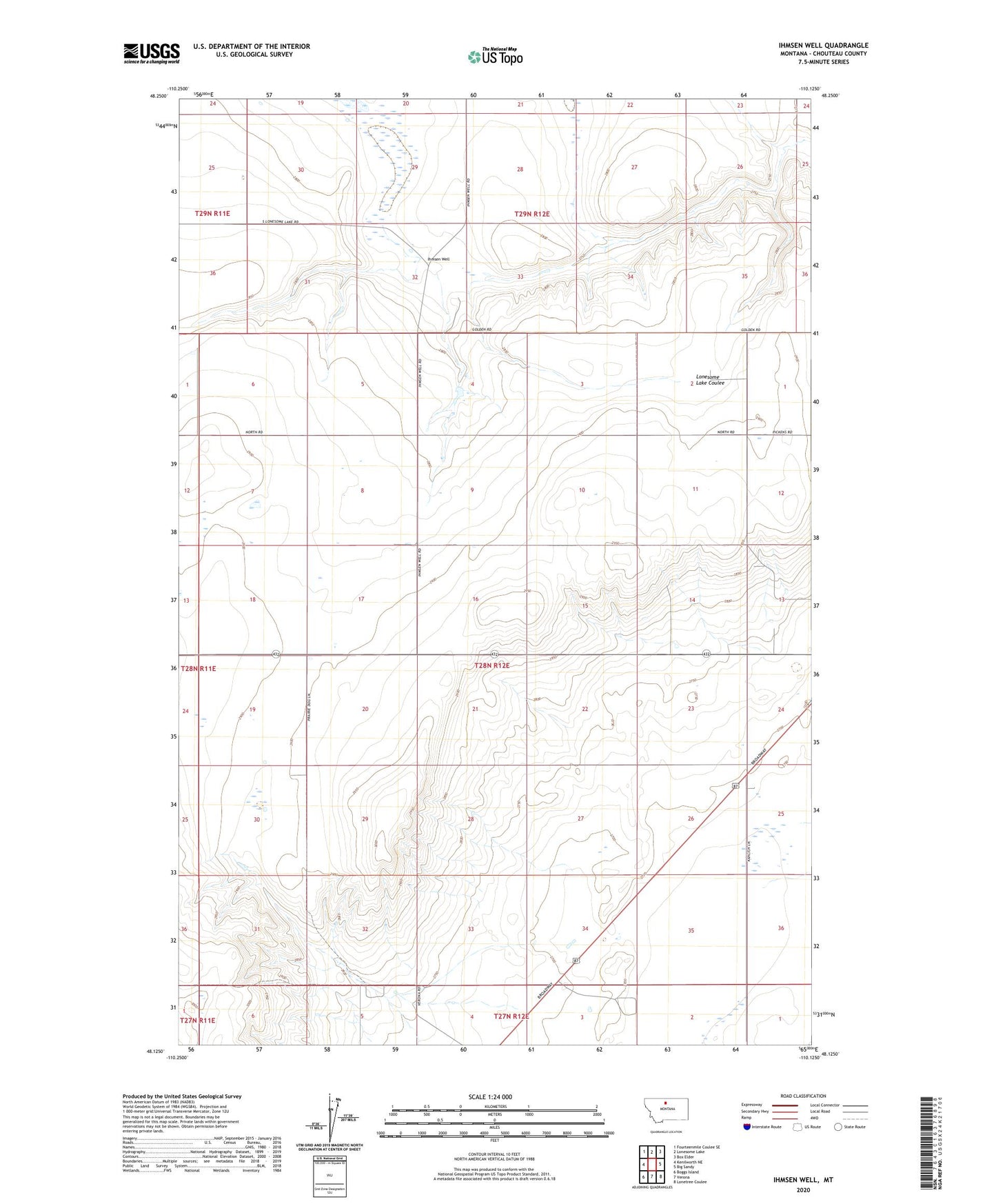
2024 topographic map quadrangle Ihmsen Well in the state of Montana. Scale: 1:24000. Based on the newly updated USGS 7.5' US Topo map series, this map is in the following counties: Chouteau. The map contains contour data, water features, and other items you are used to seeing on USGS maps, but also has updated roads and other features. This is the next generation of topographic maps. Printed on high-quality waterproof paper with UV fade-resistant inks.
Quads adjacent to this one:
West: Kenilworth NE
Northwest: Fourteenmile Coulee SE
North: Lonesome Lake
Northeast: Box Elder
East: Big Sandy
Southeast: Lonetree Coulee
South: Verona
Southwest: Boggs Island
This map covers the same area as the classic USGS quad with code o48110b2.
Contains the following named places: 28N12E02AC__01 Well, 28N12E02DB__01 Well, 28N12E03DA__01 Well, 28N12E08DD__01 Well, 28N12E11AA__01 Well, 28N12E13BD__01 Well, 28N12E16AA__01 Well, 28N12E24CA__01 Well, 28N12E33CCCC01 Well, 29N12E26AD__01 Well, 29N12E32BD__01 Well, 29N12E32DB__01 Well, 29N12E34DD__01 Well, 29N12E35DC__01 Well, 29N12E35DC__02 Well, Cornett Fish Dam, Ihmsen Well