MyTopo
Boggs Island Montana US Topo Map
Couldn't load pickup availability
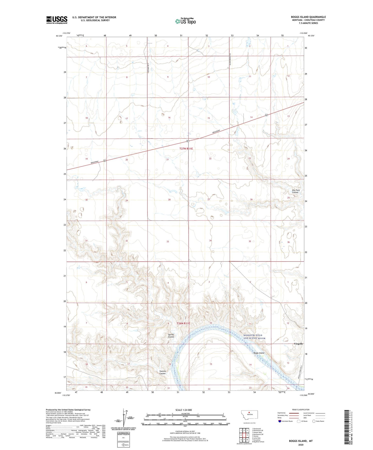
2024 topographic map quadrangle Boggs Island in the state of Montana. Scale: 1:24000. Based on the newly updated USGS 7.5' US Topo map series, this map is in the following counties: Chouteau. The map contains contour data, water features, and other items you are used to seeing on USGS maps, but also has updated roads and other features. This is the next generation of topographic maps. Printed on high-quality waterproof paper with UV fade-resistant inks.
Quads adjacent to this one:
West: Kenilworth SW
Northwest: Kenilworth
North: Kenilworth NE
Northeast: Ihmsen Well
East: Verona
Southeast: Big Bend School
South: Stranahan
Southwest: Loma East
This map covers the same area as the classic USGS quad with code o48110a3.
Contains the following named places: 27N11E04CCBB01 Well, Boggs Island, Diomedes Dam, Dionysia Dam, Dry Fork Coulee, Dyan Dam, Halverson Ranch Dam, Halverson Ranch Incorporated Number 1 Dam, Inga, Inga Post Office, Little School, Mount Vernon School, Sixmile Coulee, Spring Coulee, Tryannosaurus Dam, Virgelle, Virgelle Ferry, Virgelle Post Office, Virgelle School