MyTopo
Kent Peak Montana US Topo Map
Couldn't load pickup availability
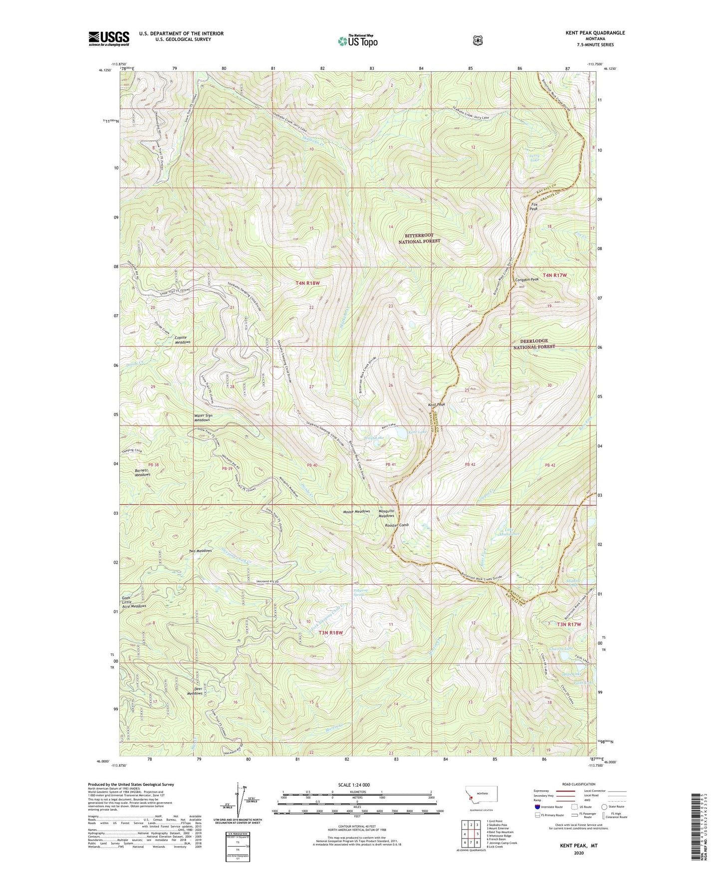
2020 topographic map quadrangle Kent Peak in the state of Montana. Scale: 1:24000. Based on the newly updated USGS 7.5' US Topo map series, this map is in the following counties: Ravalli, Granite. The map contains contour data, water features, and other items you are used to seeing on USGS maps, but also has updated roads and other features. This is the next generation of topographic maps. Printed on high-quality waterproof paper with UV fade-resistant inks.
Quads adjacent to this one:
West: Bald Top Mountain
Northwest: Gird Point
North: Skalkaho Pass
Northeast: Mount Emerine
East: Whetstone Ridge
Southeast: Lick Creek
South: Jennings Camp Creek
Southwest: French Basin
Contains the following named places: Barnett Meadows, Charity Lake, Congdon Peak, Cougar Creek, Coyote Meadows, Deer Meadows, Fox Peak, Gods Little Acre Meadows, Hope Lake, Jerry Lake, Kent Lake, Kent Peak, Lake Abundance, Lost Tooth Cabin, Moose Meadows, Mosquito Meadows, Pollywog Spring, Rooster Comb, Sapphire Mountains, Shadow Lake, South Fork Sleeping Child Creek, Trout Lake, Two Meadows, Water Sign Meadows