MyTopo
Physic Creek Montana US Topo Map
Couldn't load pickup availability
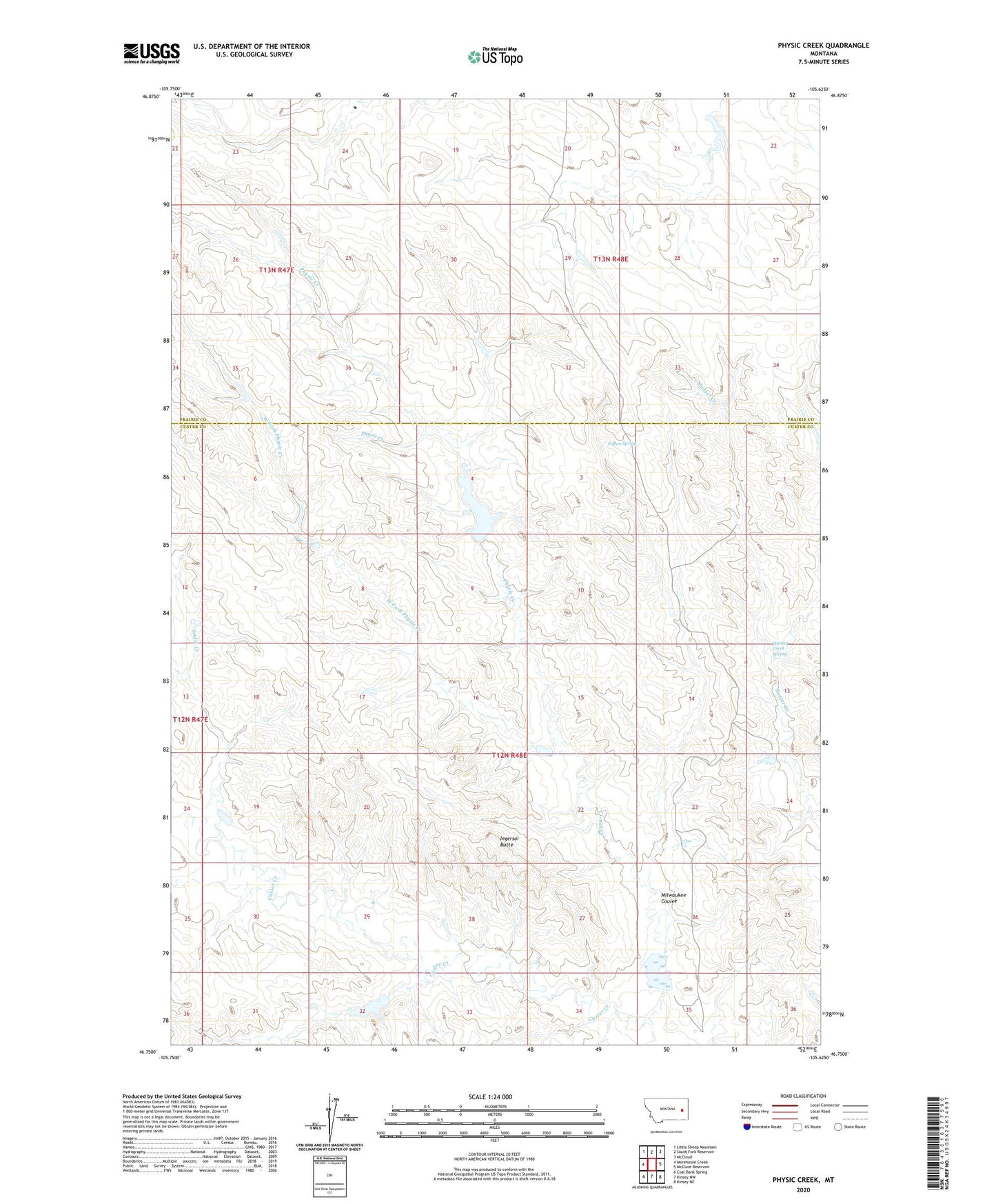
2024 topographic map quadrangle Physic Creek in the state of Montana. Scale: 1:24000. Based on the newly updated USGS 7.5' US Topo map series, this map is in the following counties: Custer, Prairie. The map contains contour data, water features, and other items you are used to seeing on USGS maps, but also has updated roads and other features. This is the next generation of topographic maps. Printed on high-quality waterproof paper with UV fade-resistant inks.
Quads adjacent to this one:
West: Morehouse Creek
Northwest: Little Sheep Mountain
North: South Fork Reservoir
Northeast: McCloud
East: McClure Reservoir
Southeast: Kinsey NE
South: Kinsey NW
Southwest: Coal Bank Spring
This map covers the same area as the classic USGS quad with code o46105g6.
Contains the following named places: 13N47E23BDDA01 Well, 13N47E24BACA01 Well, 13N47E26DAAC01 Well, 13N47E26DAAD01 Well, 13N48E20CDDC01 Well, 13N48E28DACC01 Well, 13N48E29CBCA01 Well, 13N48E33BBCA01 Well, Fallon Spring, Grant Reservoir, Grant Reservoir Dam, Harmes Reservoir Dam, Haughan Number 2 Dam, Haughian Number 15 Dam, Haughian Number 16 Dam, Hunter Creek Spring, Ingersol Butte, Milwaukee Coulee, Physic Creek, Physic Creek Dam, Physic Creek Reservoir, Reed Number 4 Dam, Reed Number 5 Dam, Rundel School, Sadie Creek, Swede Dam, West Fork Physic Creek