MyTopo
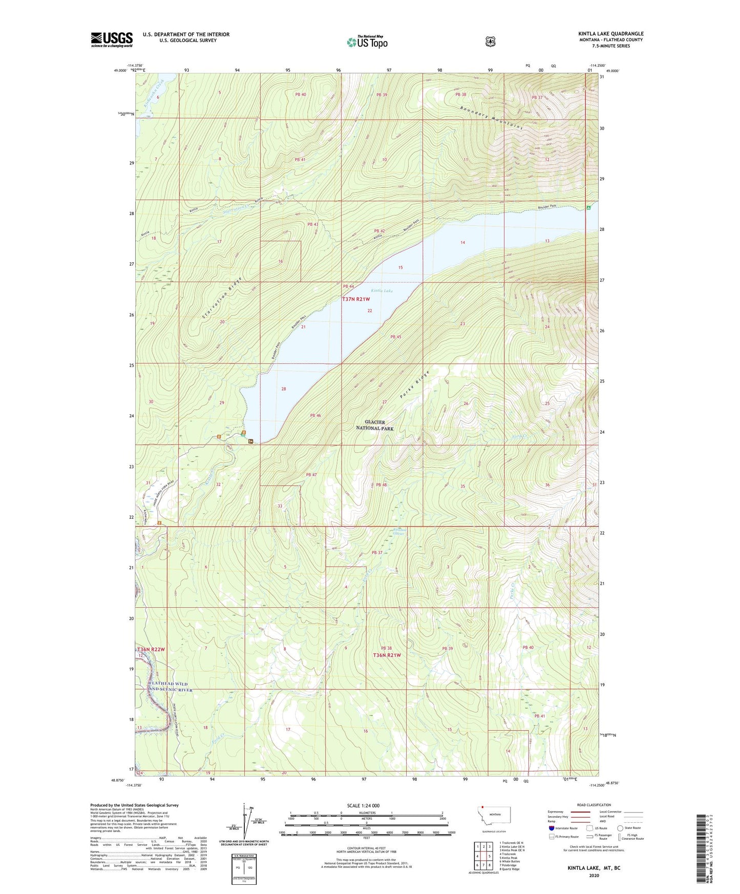
Kintla Lake Montana US Topo Map
Couldn't load pickup availability
Also explore the Kintla Lake Forest Service Topo of this same quad for updated USFS data
2024 topographic map quadrangle Kintla Lake in the state of Montana. Scale: 1:24000. Based on the newly updated USGS 7.5' US Topo map series, this map is in the following counties: Flathead. The map contains contour data, water features, and other items you are used to seeing on USGS maps, but also has updated roads and other features. This is the next generation of topographic maps. Printed on high-quality waterproof paper with UV fade-resistant inks.
Quads adjacent to this one:
West: Trailcreek
Northwest: Trailcreek OE N
North: Kintla Lake OE N
Northeast: Kintla Peak OE N
East: Kintla Peak
Southeast: Quartz Ridge
South: Polebridge
Southwest: Whale Buttes
This map covers the same area as the classic USGS quad with code o48114h3.
Contains the following named places: 37N21W29DDC_01 Well, Butte Well, Ford River Access, Kintla Creek, Kintla Lake, Kintla Lake Campground, Parke Ridge, Starvation Ridge, Tepee Creek