MyTopo
Kintla Peak Montana US Topo Map
Couldn't load pickup availability
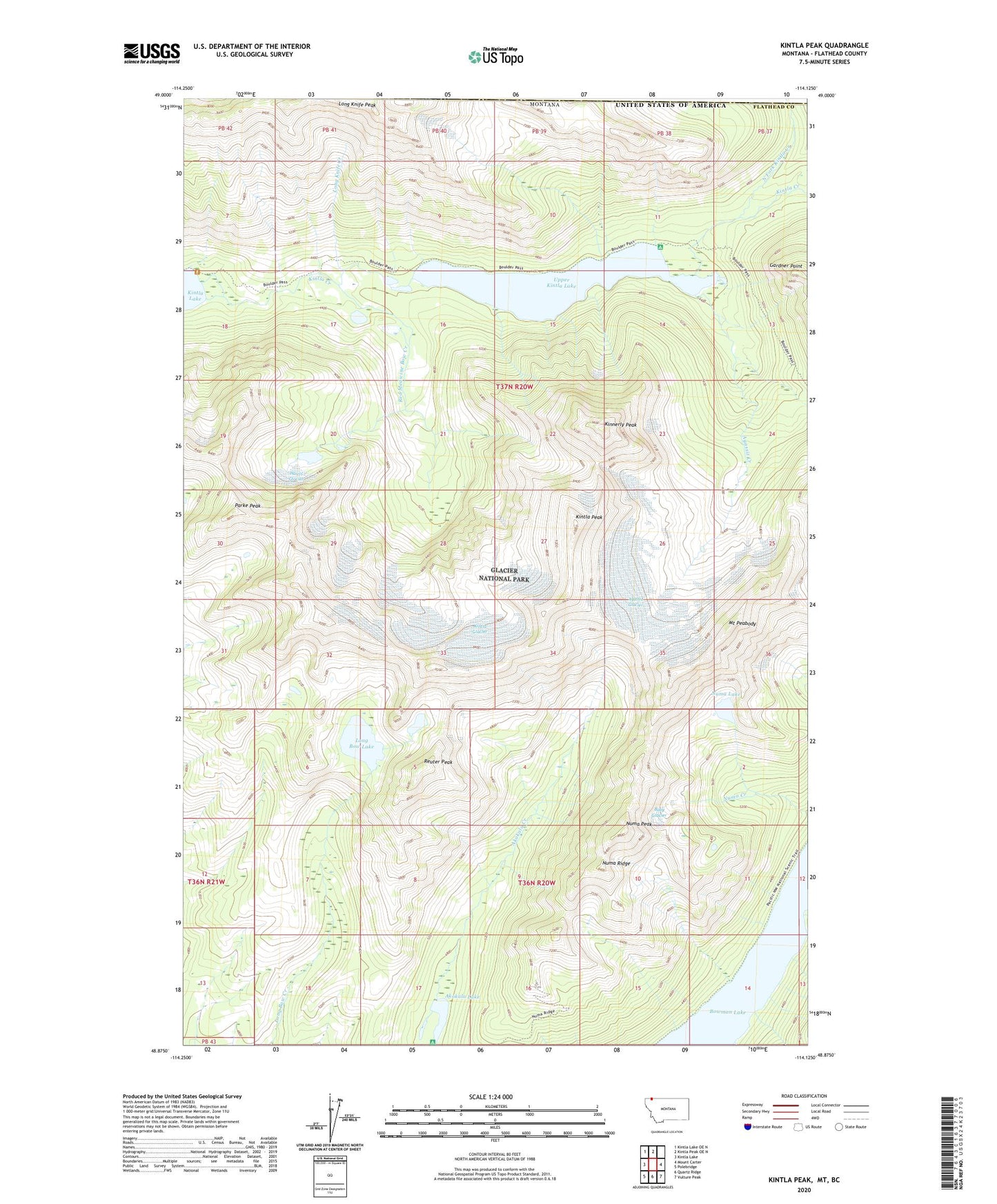
2024 topographic map quadrangle Kintla Peak in the state of Montana. Scale: 1:24000. Based on the newly updated USGS 7.5' US Topo map series, this map is in the following counties: Flathead. The map contains contour data, water features, and other items you are used to seeing on USGS maps, but also has updated roads and other features. This is the next generation of topographic maps. Printed on high-quality waterproof paper with UV fade-resistant inks.
Quads adjacent to this one:
West: Kintla Lake
Northwest: Kintla Lake OE N
North: Kintla Peak OE N
East: Mount Carter
Southeast: Vulture Peak
South: Quartz Ridge
Southwest: Polebridge
This map covers the same area as the classic USGS quad with code o48114h2.
Contains the following named places: Agassiz Creek, Agassiz Glacier, Akokala Lake, Baby Glacier, Boulder Pass Trail, Boundary Mountains, Bowman Lake Trail, Gardner Point, Harris Glacier, Kinnerly Peak, Kintla Glacier, Kintla Peak, Long Bow Lake, Long Knife Creek, Long Knife Peak, Mount Peabody, North Fork Kintla Creek, Numa Lake, Numa Peak, Numa Ridge, Parke Peak, Red Medicine Bow Creek, Reuter Peak, Upper Kintla Lake