MyTopo
Lake Bowdoin Montana US Topo Map
Couldn't load pickup availability
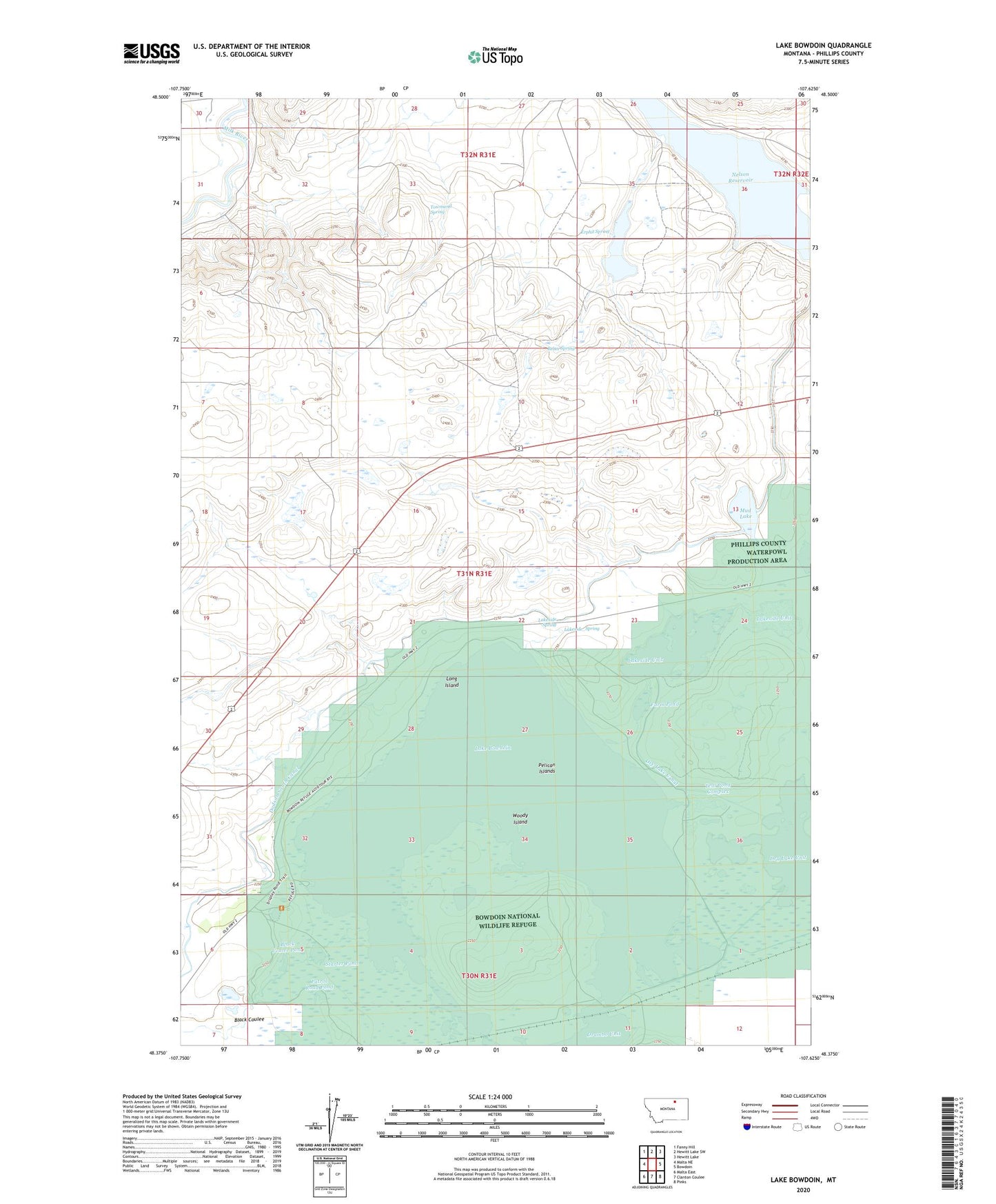
2020 topographic map quadrangle Lake Bowdoin in the state of Montana. Scale: 1:24000. Based on the newly updated USGS 7.5' US Topo map series, this map is in the following counties: Phillips. The map contains contour data, water features, and other items you are used to seeing on USGS maps, but also has updated roads and other features. This is the next generation of topographic maps. Printed on high-quality waterproof paper with UV fade-resistant inks.
Quads adjacent to this one:
West: Malta NE
Northwest: Fanny Hill
North: Hewitt Lake SW
Northeast: Hewitt Lake
East: Bowdoin
Southeast: Pinks
South: Clanton Coulee
Southwest: Malta East
Contains the following named places: 31N31E22DAC_10 Well, Bebee Spring, Black Coulee, Black Coulee Pond, Bowdoin National Wildlife Refuge, Dry Lake Canal, Erphit Lake, Erphit Spring, Farm Pond, Lake Bowdoin, Lakeside Spring, Lakeside Unit, Lone Tree Lake, Long Island, Mud Lake, North Strater School, Patrol Road Pond, Pelican Islands, Starter Pond, Strater School, Teal Pond Complex, Townsend Spring, Woody Island