MyTopo
Clanton Coulee Montana US Topo Map
Couldn't load pickup availability
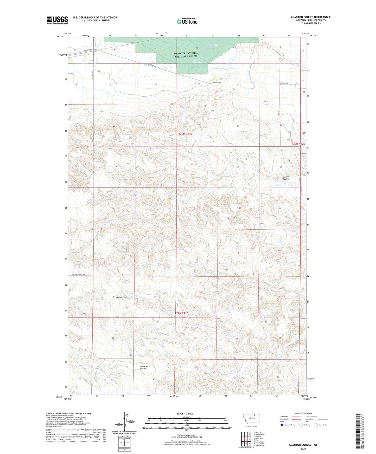
2024 topographic map quadrangle Clanton Coulee in the state of Montana. Scale: 1:24000. Based on the newly updated USGS 7.5' US Topo map series, this map is in the following counties: Phillips. The map contains contour data, water features, and other items you are used to seeing on USGS maps, but also has updated roads and other features. This is the next generation of topographic maps. Printed on high-quality waterproof paper with UV fade-resistant inks.
Quads adjacent to this one:
West: Malta East
Northwest: Malta NE
North: Lake Bowdoin
Northeast: Bowdoin
East: Pinks
Southeast: Johnson Dam
South: Content NW
Southwest: Bennett Lake
This map covers the same area as the classic USGS quad with code o48107c6.
Contains the following named places: 29N31E24DC__01 Well, 30N31E12D__BOWDO Well, 30N31E15CAA__BOW Well, Clanton Coulee, Drumbo Unit, East Strater School, Goose Island Pond, Prairie Center School, Strater, Strater Post Office