MyTopo
Pinks Montana US Topo Map
Couldn't load pickup availability
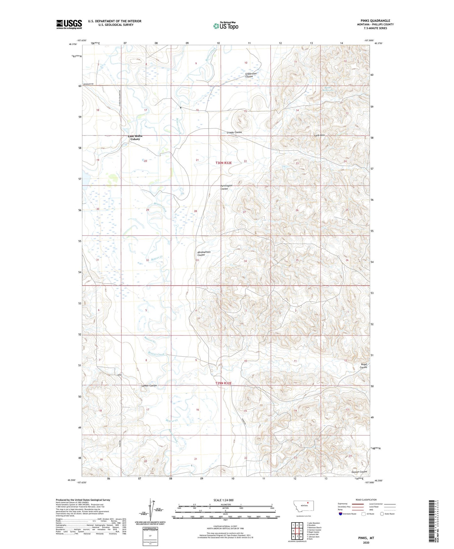
2024 topographic map quadrangle Pinks in the state of Montana. Scale: 1:24000. Based on the newly updated USGS 7.5' US Topo map series, this map is in the following counties: Phillips. The map contains contour data, water features, and other items you are used to seeing on USGS maps, but also has updated roads and other features. This is the next generation of topographic maps. Printed on high-quality waterproof paper with UV fade-resistant inks.
Quads adjacent to this one:
West: Clanton Coulee
Northwest: Lake Bowdoin
North: Bowdoin
Northeast: Robinson Ranch
East: Regal Coulee
Southeast: Harb
South: Johnson Dam
Southwest: Content NW
This map covers the same area as the classic USGS quad with code o48107c5.
Contains the following named places: Abrahamson Coulee, Bauer Reservoir, Beaver Creek School, Crooks Coulee, East Malta Colony, East Malta Colony Census Designated Place, Gilbertson Coulee, LeNoir Coulee, LeNoir Reservoir, Pennington Coulee, Pinks, Regal Coulee