MyTopo
Lake Reservoir Montana US Topo Map
Couldn't load pickup availability
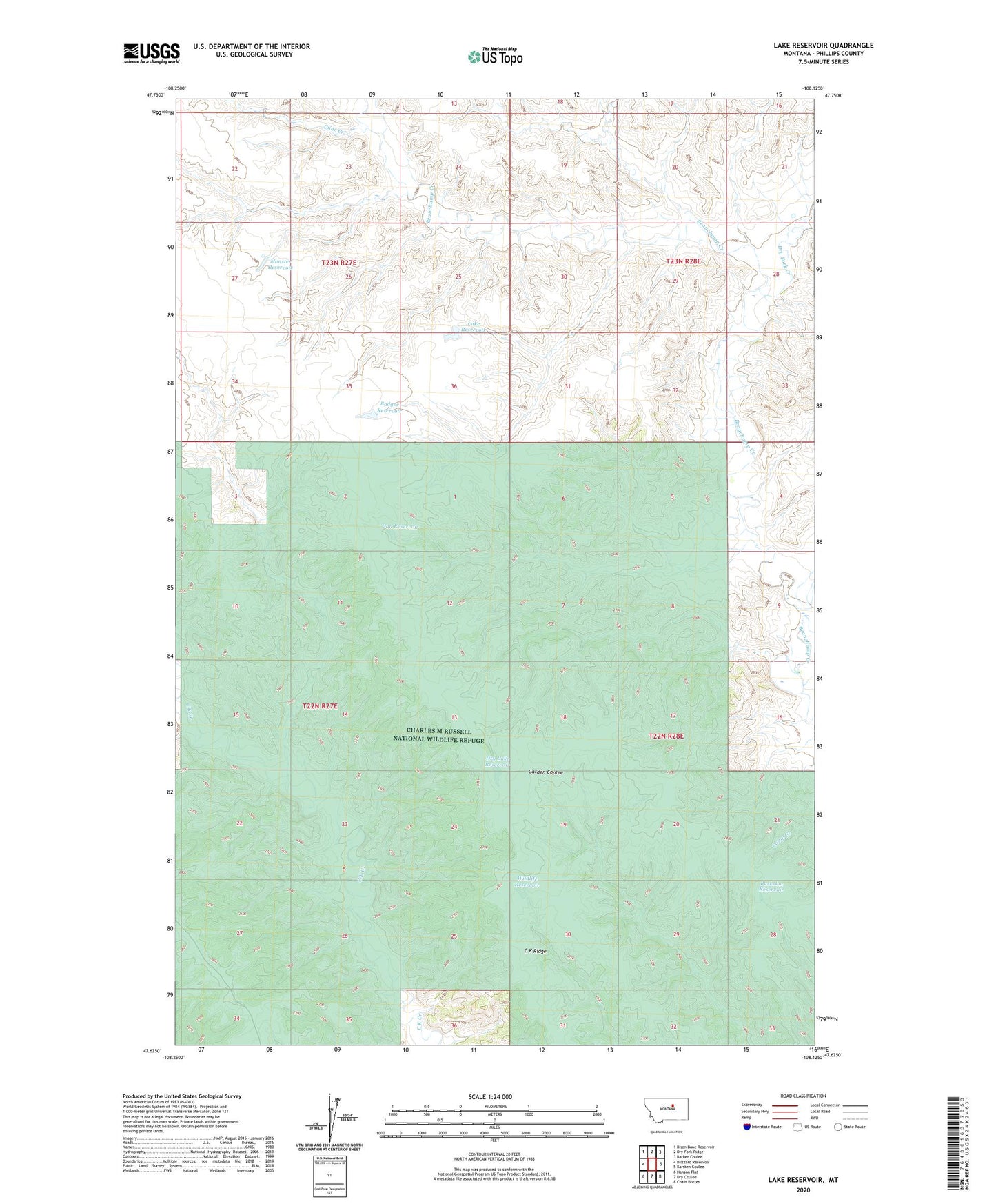
2020 topographic map quadrangle Lake Reservoir in the state of Montana. Scale: 1:24000. Based on the newly updated USGS 7.5' US Topo map series, this map is in the following counties: Phillips. The map contains contour data, water features, and other items you are used to seeing on USGS maps, but also has updated roads and other features. This is the next generation of topographic maps. Printed on high-quality waterproof paper with UV fade-resistant inks.
Quads adjacent to this one:
West: Blizzard Reservoir
Northwest: Bison Bone Reservoir
North: Dry Fork Ridge
Northeast: Barber Coulee
East: Karsten Coulee
Southeast: Chain Buttes
South: Dry Coulee
Southwest: Hanson Flat
Contains the following named places: 22N27E23____01 Well, 22N27E23DBCB01 Well, Badger Reservoir, Buckskin Reservoir, Cline Creek, Dan Reservoir, Dry Fork Creek, Dry Lake Reservoir, Lake Reservoir, Lake Reservoir Dam, Monster Reservoir, Wildlife Reservoir