MyTopo
Chain Buttes Montana US Topo Map
Couldn't load pickup availability
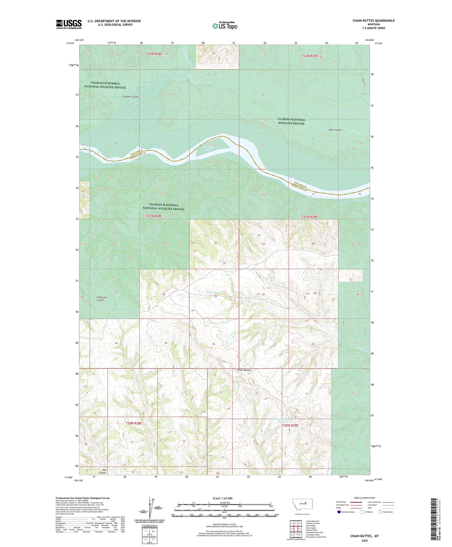
2024 topographic map quadrangle Chain Buttes in the state of Montana. Scale: 1:24000. Based on the newly updated USGS 7.5' US Topo map series, this map is in the following counties: Petroleum, Phillips. The map contains contour data, water features, and other items you are used to seeing on USGS maps, but also has updated roads and other features. This is the next generation of topographic maps. Printed on high-quality waterproof paper with UV fade-resistant inks.
Quads adjacent to this one:
West: Dry Coulee
Northwest: Lake Reservoir
North: Karsten Coulee
Northeast: Pea Ridge
East: Locke Ranch
Southeast: Germaine Coulee West
South: Weingart Place
Southwest: Weingart Place NW
This map covers the same area as the classic USGS quad with code o47108e1.
Contains the following named places: 21N28E02BB__01 Well, 21N29E04CC__01 Well, 21N29E06CA__01 Well, Beauchamp Creek, Ceekay Post Office, Chain Buttes, Dam Coulee, Gairrett School, Garden Coulee, Hawley Creek, Headman-Field Reservoir