MyTopo
Lake Seventeen West Montana US Topo Map
Couldn't load pickup availability
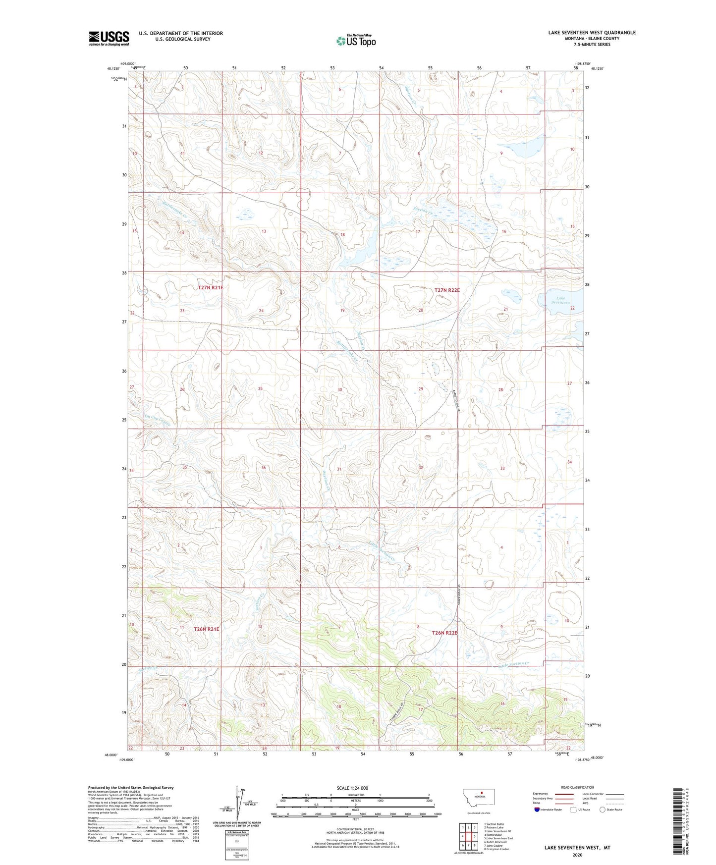
2024 topographic map quadrangle Lake Seventeen West in the state of Montana. Scale: 1:24000. Based on the newly updated USGS 7.5' US Topo map series, this map is in the following counties: Blaine. The map contains contour data, water features, and other items you are used to seeing on USGS maps, but also has updated roads and other features. This is the next generation of topographic maps. Printed on high-quality waterproof paper with UV fade-resistant inks.
Quads adjacent to this one:
West: Rattlesnake
Northwest: Suction Butte
North: Putnam Lake
Northeast: Lake Seventeen NE
East: Lake Seventeen East
Southeast: Crazyman Coulee
South: John Coulee
Southwest: Butch Reservoir
This map covers the same area as the classic USGS quad with code o48108a8.
Contains the following named places: 27N22E30BABC01 Well, Carter Dam, Harrison School, Jacks Coulee, Little Suction Creek, Mitchell Dam, Rattlesnake Creek, Timber Ridge, Timber Ridge Post Office, Timber Ridge School, Tin Cup Coulee, West Fork Jacks Coulee