MyTopo
Lick Creek Montana US Topo Map
Couldn't load pickup availability
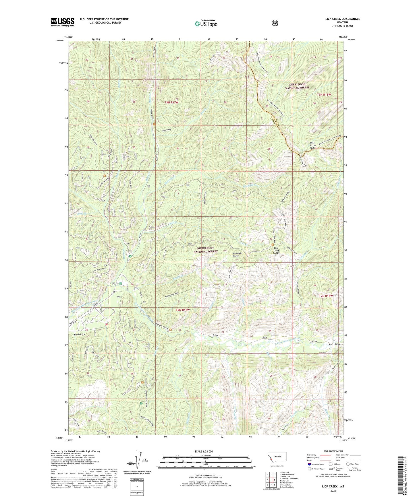
2020 topographic map quadrangle Lick Creek in the state of Montana. Scale: 1:24000. Based on the newly updated USGS 7.5' US Topo map series, this map is in the following counties: Ravalli, Granite. The map contains contour data, water features, and other items you are used to seeing on USGS maps, but also has updated roads and other features. This is the next generation of topographic maps. Printed on high-quality waterproof paper with UV fade-resistant inks.
Quads adjacent to this one:
West: Jennings Camp Creek
Northwest: Kent Peak
North: Whetstone Ridge
Northeast: Moose Lake
East: Kelly Lake
Southeast: Mussigbrod Lake
South: Bender Point
Southwest: Schultz Saddle
Contains the following named places: Billie Springer Memorial Park, Buck Creek, Bush Creek, Carmine Creek, Clifford Creek, Cub Creek, East Fork Forest Service Station, East Fork Trailhead, Echo Gulch, Fish Lake Trailhead, Hole in the Wall, Hope Creek, Kurtz Creek, Kurtz Flats, Lick Creek, Lick Creek Saddle, Martin Creek, Martin Creek Campground, McCart Trailhead, Moose Creek, Moss Creek, Needle Creek, Orphan Creek, Paint Creek, Reynolds Creek, Sign Creek, Sign Creek Trailhead, Sign Signal Trailhead, Sula Rural Fire District Station 2, Sun Creek, Vapor Creek