MyTopo
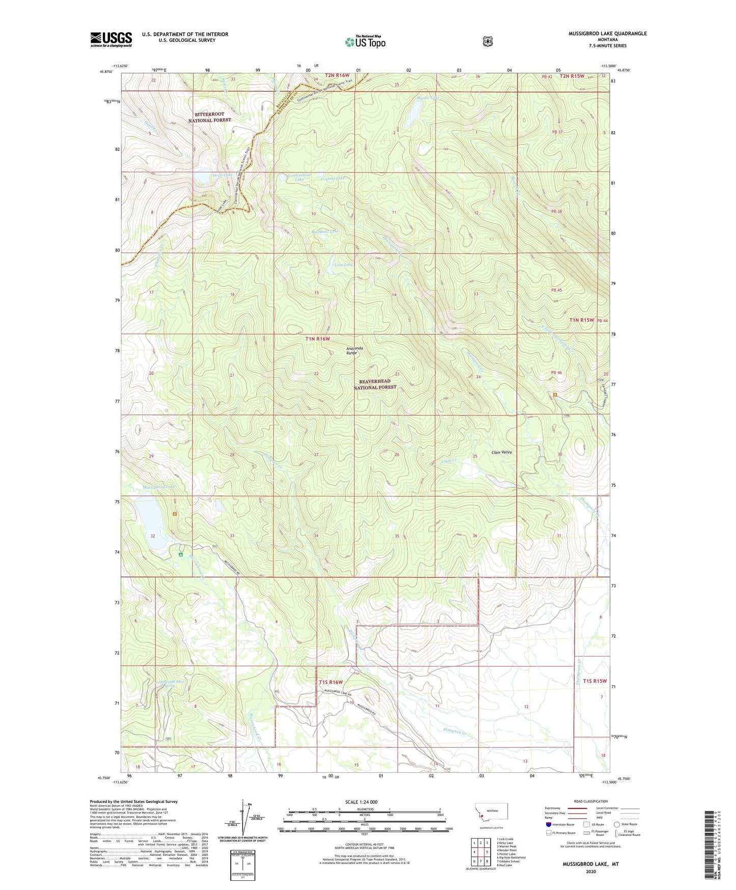
Mussigbrod Lake Montana US Topo Map
Couldn't load pickup availability
Also explore the Mussigbrod Lake Forest Service Topo of this same quad for updated USFS data
2024 topographic map quadrangle Mussigbrod Lake in the state of Montana. Scale: 1:24000. Based on the newly updated USGS 7.5' US Topo map series, this map is in the following counties: Beaverhead, Ravalli. The map contains contour data, water features, and other items you are used to seeing on USGS maps, but also has updated roads and other features. This is the next generation of topographic maps. Printed on high-quality waterproof paper with UV fade-resistant inks.
Quads adjacent to this one:
West: Bender Point
Northwest: Lick Creek
North: Kelly Lake
Northeast: Warren Peak
East: Pintler Lake
Southeast: Mud Lake
South: Gibbons School
Southwest: Big Hole Battlefield
This map covers the same area as the classic USGS quad with code o45113g5.
Contains the following named places: 01N16W32DABD01 Well, 01S16W08BCAB01 Spring, 01S16W10CBCA01 Well, 01S16W10CBCB01 Well, Clam Creek, Clam Valley, Continental Lake, Crystal Lake, Hope Lake, Lion Lake, Mosquito Lake, Mussigbrod Campground, Mussigbrod Lake, Mussigbrod Lake Dam, Mystic Lake, Mystic Lake Forest Service Facility, Spannuth Ranch