MyTopo
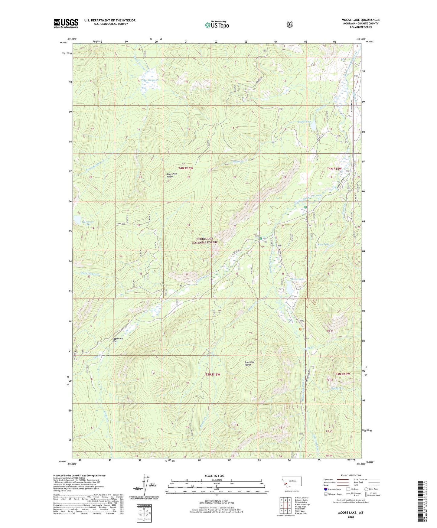
Moose Lake Montana US Topo Map
Couldn't load pickup availability
Also explore the Moose Lake Forest Service Topo of this same quad for updated USFS data
2024 topographic map quadrangle Moose Lake in the state of Montana. Scale: 1:24000. Based on the newly updated USGS 7.5' US Topo map series, this map is in the following counties: Granite. The map contains contour data, water features, and other items you are used to seeing on USGS maps, but also has updated roads and other features. This is the next generation of topographic maps. Printed on high-quality waterproof paper with UV fade-resistant inks.
Quads adjacent to this one:
West: Whetstone Ridge
Northwest: Mount Emerine
North: Maukey Gulch
Northeast: Potato Lakes
East: Carpp Ridge
Southeast: Warren Peak
South: Kelly Lake
Southwest: Lick Creek
This map covers the same area as the classic USGS quad with code o46113a5.
Contains the following named places: Abe Lincone Mine, Banner Mine, Carpp Creek, Copper Creek, Copper Creek Campground, Cougar Creek, Cutthroat Creek, Falls Fork Rock Creek, Green Canyon Creek, Happy Creek, Kaiser Lake, Lone Pine Ridge, Lutz Creek, Meyers Creek, Middle Fork Rock Creek, Moose Lake, Moose Lake Mine, Old Dominion Mine, Placer Creek, Sagebrush Flat, Senate Creek, Susie Lake, Whetstone Lake, Zekes Meadows