MyTopo
Lindsay Montana US Topo Map
Couldn't load pickup availability
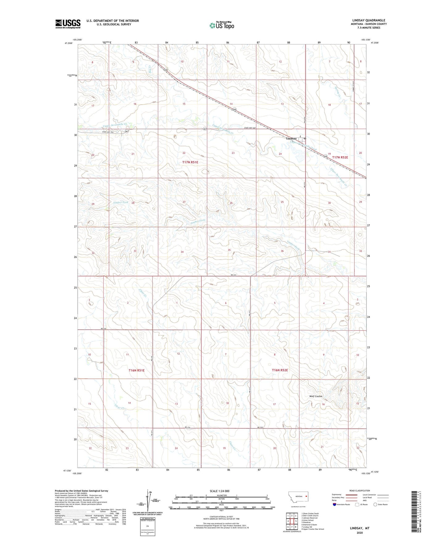
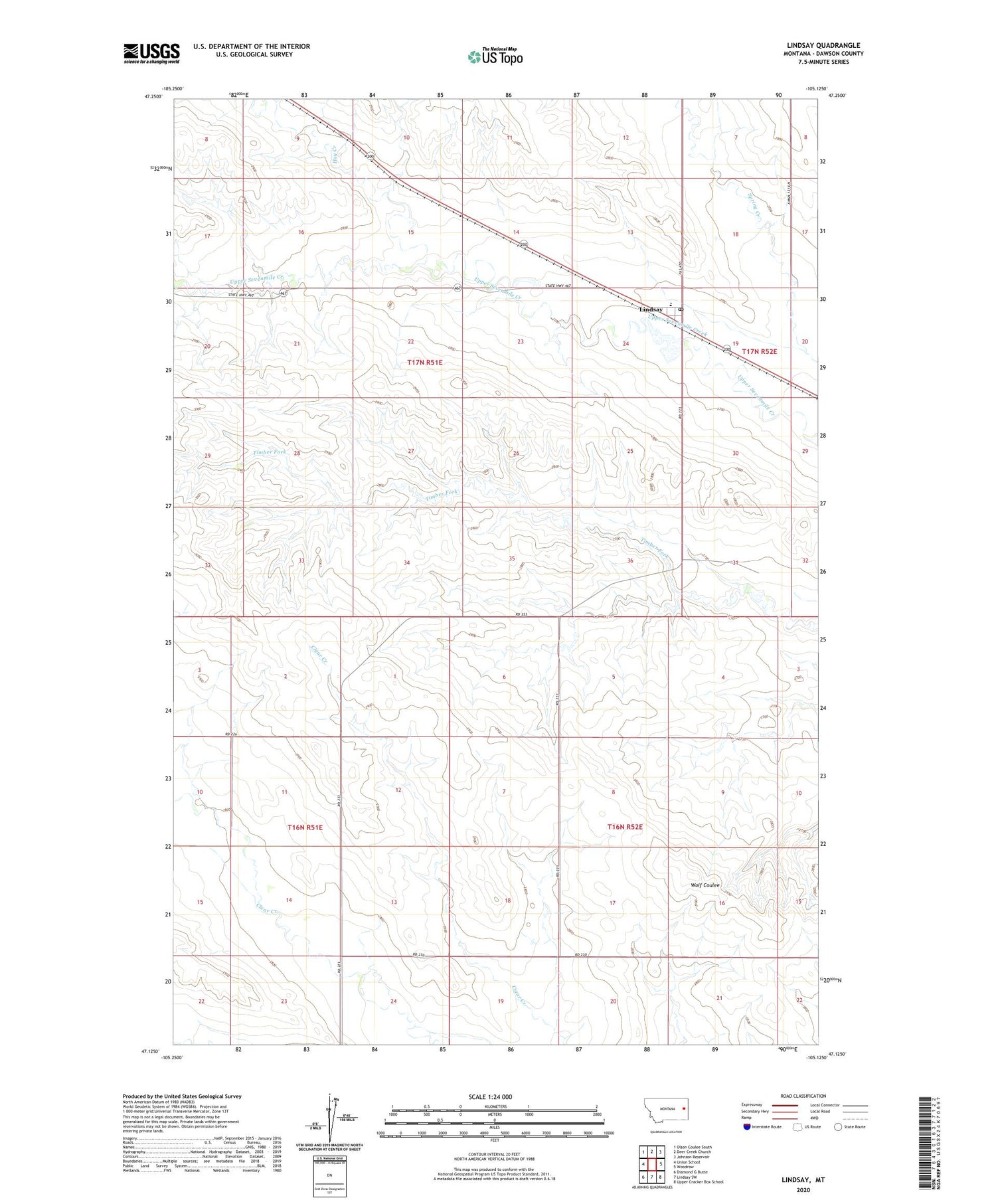
2020 topographic map quadrangle Lindsay in the state of Montana. Scale: 1:24000. Based on the newly updated USGS 7.5' US Topo map series, this map is in the following counties: Dawson. The map contains contour data, water features, and other items you are used to seeing on USGS maps, but also has updated roads and other features. This is the next generation of topographic maps. Printed on high-quality waterproof paper with UV fade-resistant inks.
Quads adjacent to this one:
West: Union School
Northwest: Olson Coulee South
North: Deer Creek Church
Northeast: Johnson Reservoir
East: Woodrow
Southeast: Upper Cracker Box School
South: Lindsay SW
Southwest: Diamond G Butte
Contains the following named places: 16N52E08BAB_01 Well, 17N51E13BDA_01 Well, 17N51E28DDC_01 Well, Baggs School, Danial Downs Number 2 Dam, Danial Downs Number 4 Dam, Farmers Elevator, Hay Creek, Lindsay, Lindsay Census Designated Place, Lindsay Dam, Lindsay Post Office, Lindsay Reservoir, Lindsay School, Timber Fork School