MyTopo
Lonetree Coulee Montana US Topo Map
Couldn't load pickup availability
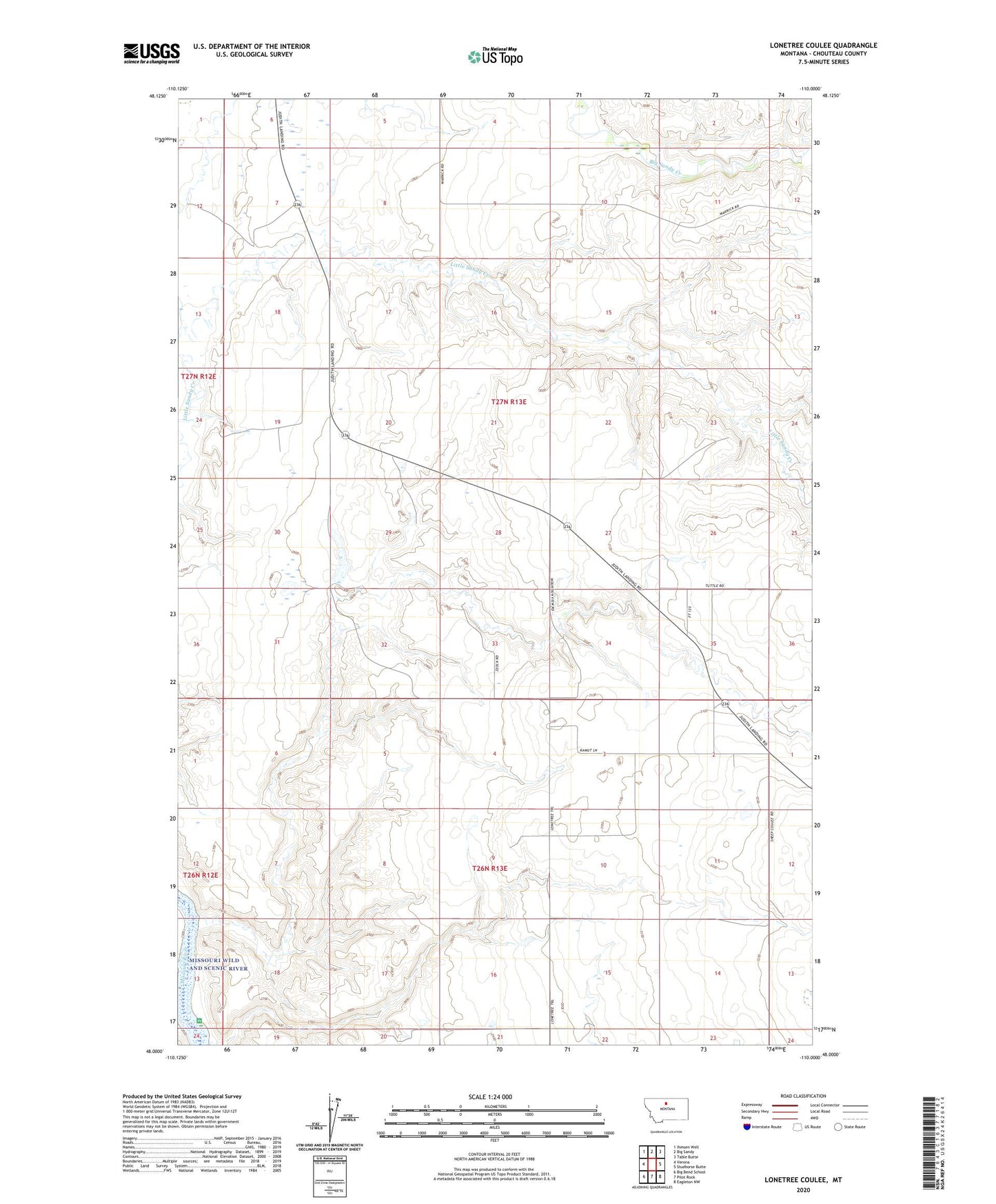
2024 topographic map quadrangle Lonetree Coulee in the state of Montana. Scale: 1:24000. Based on the newly updated USGS 7.5' US Topo map series, this map is in the following counties: Chouteau. The map contains contour data, water features, and other items you are used to seeing on USGS maps, but also has updated roads and other features. This is the next generation of topographic maps. Printed on high-quality waterproof paper with UV fade-resistant inks.
Quads adjacent to this one:
West: Verona
Northwest: Ihmsen Well
North: Big Sandy
Northeast: Table Butte
East: Studhorse Butte
Southeast: Eagleton NW
South: Pilot Rock
Southwest: Big Bend School
This map covers the same area as the classic USGS quad with code o48110a1.
Contains the following named places: Alkali Coulee, Big Sandy Division, Dodecanese Dam, Lonetree Coulee, Lonetree School, MacDonalds Farm Reservoir Dam, Osterized Dam