MyTopo
MacDonald Pass Montana US Topo Map
Couldn't load pickup availability
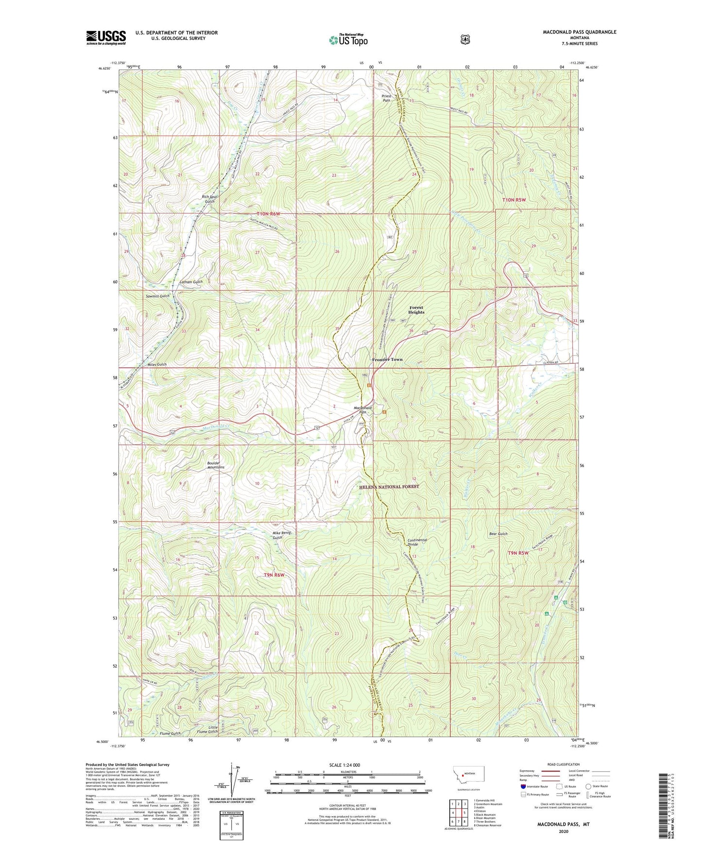
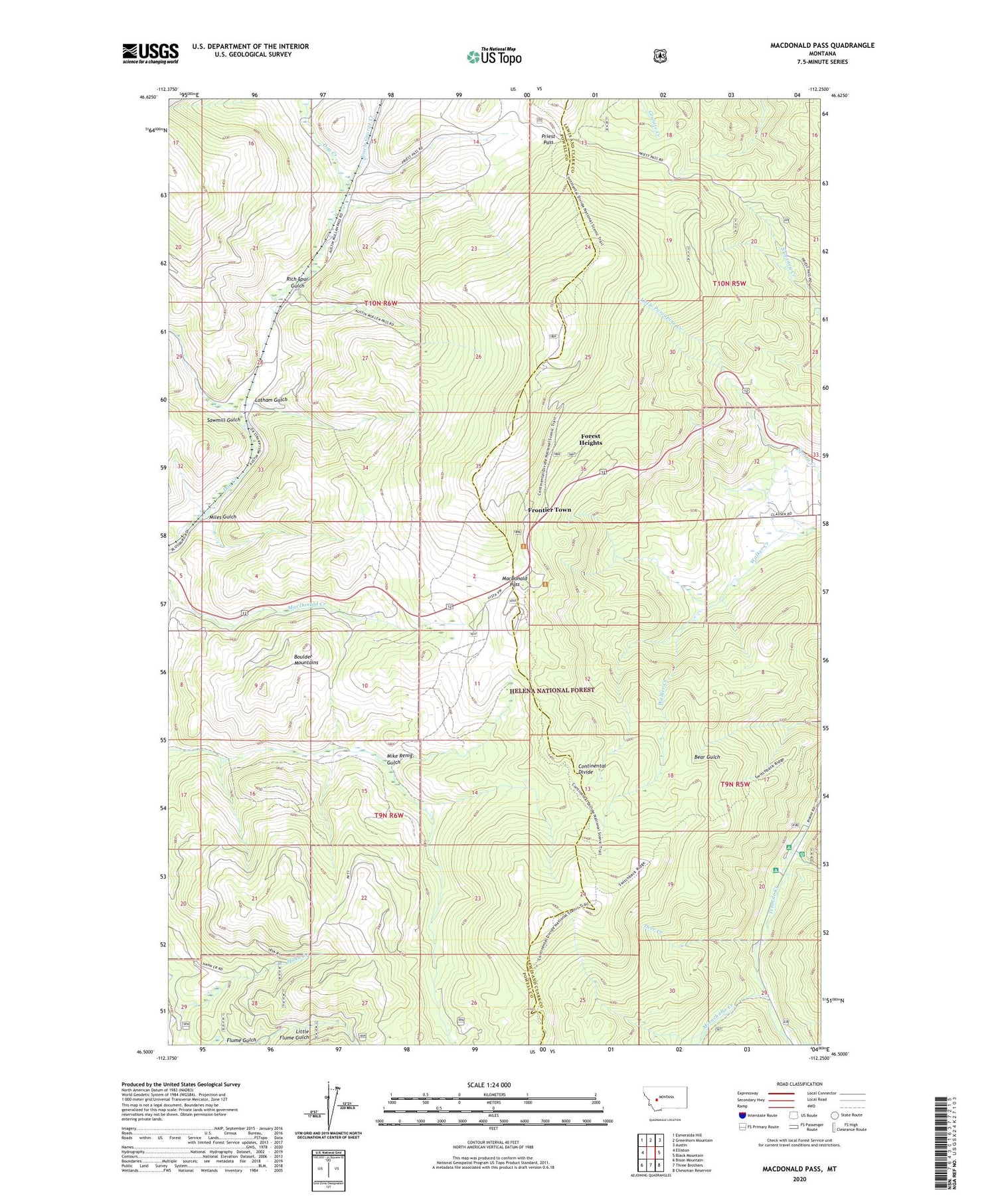
2020 topographic map quadrangle MacDonald Pass in the state of Montana. Scale: 1:24000. Based on the newly updated USGS 7.5' US Topo map series, this map is in the following counties: Powell, Lewis and Clark. The map contains contour data, water features, and other items you are used to seeing on USGS maps, but also has updated roads and other features. This is the next generation of topographic maps. Printed on high-quality waterproof paper with UV fade-resistant inks.
Quads adjacent to this one:
West: Elliston
Northwest: Esmeralda Hill
North: Greenhorn Mountain
Northeast: Austin
East: Black Mountain
Southeast: Chessman Reservoir
South: Three Brothers
Southwest: Bison Mountain
Contains the following named places: Bear Gulch Trail, Boy Scout Camp, Camp Thunderbird, Clarkston Post Office, Cromwell Dixon Campground, Deer Creek, Forest Heights, Frontier Town, Hahn Creek, Latham Gulch, Little Porcupine Creek, MacDonald Pass, MacDonald Pass Campground, Miles Gulch, Minnehaha, Minnehaha Creek, Moose Creek, Moose Creek Campground, Porcupine Campground, Priest Pass, Rich, Rich Spur Gulch, Sawmill Gulch, Terra Firma, Third Term Mine, Uncle George Creek, Vista Point of Interest