MyTopo
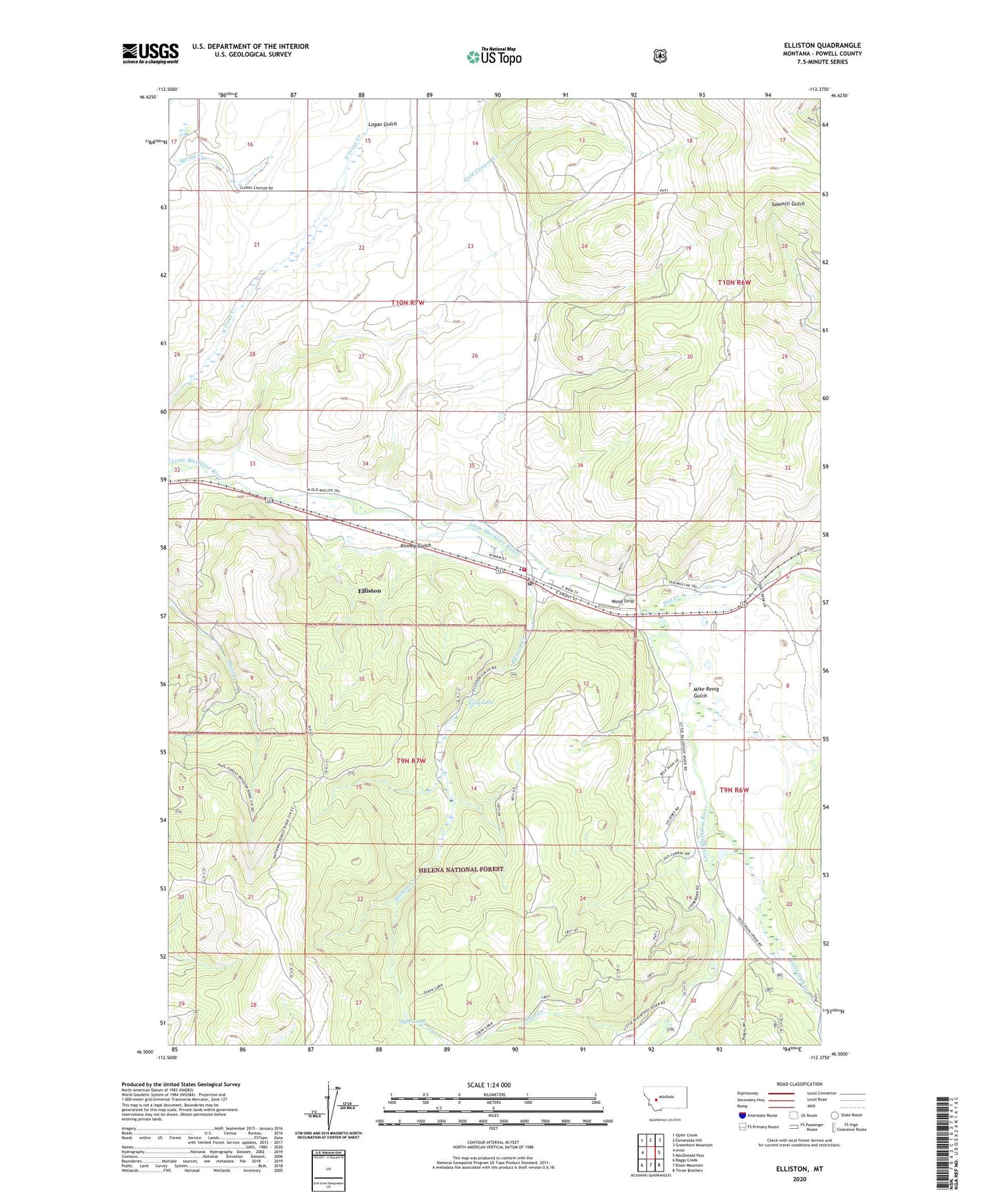
Elliston Montana US Topo Map
Couldn't load pickup availability
Also explore the Elliston Forest Service Topo of this same quad for updated USFS data
2024 topographic map quadrangle Elliston in the state of Montana. Scale: 1:24000. Based on the newly updated USGS 7.5' US Topo map series, this map is in the following counties: Powell. The map contains contour data, water features, and other items you are used to seeing on USGS maps, but also has updated roads and other features. This is the next generation of topographic maps. Printed on high-quality waterproof paper with UV fade-resistant inks.
Quads adjacent to this one:
West: Avon
Northwest: Ophir Creek
North: Esmeralda Hill
Northeast: Greenhorn Mountain
East: MacDonald Pass
Southeast: Three Brothers
South: Bison Mountain
Southwest: Baggs Creek
This map covers the same area as the classic USGS quad with code o46112e4.
Contains the following named places: 09N06W05ACCD01 Well, 09N06W06DCDA01 Well, 09N06W18BAAC01 Well, 09N06W18BBBA01 Well, 09N06W19AABC01 Well, 09N06W30CABA01 Well, 09N07W02ADDB01 Well, 09N07W02DABA01 Well, 10N07W17ADCD01 Well, 10N07W17DABB01 Well, 59728, Calcium, Cameron, Carbonate King Mine, Dog Creek, Elliston, Elliston Census Designated Place, Elliston Creek, Elliston Elementary School, Elliston Post Office, Elliston Volunteer Fire Department, Frenchwomans, Gold Canyon Creek, Kinney Gulch, Lilly Lake, Logan Gulch, MacDonald Creek, Mike Renig Gulch, Sampson, Slate Creek, Slate Lake, Sunshine Camp, Sweetland, Sweetland Post Office, Telegraph Creek, Walkers, Wood Strip, YMCA Camp Child