MyTopo
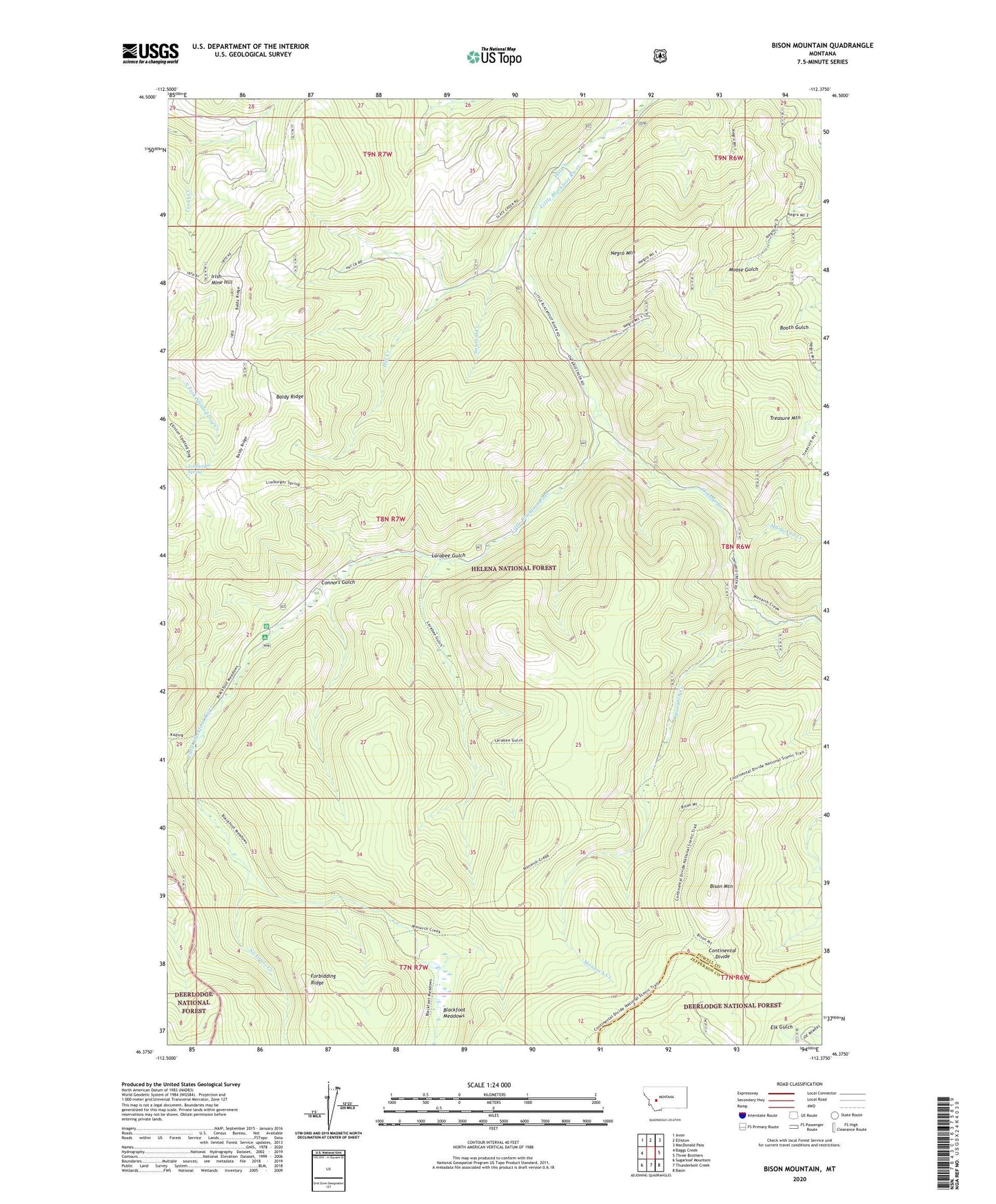
Bison Mountain Montana US Topo Map
Couldn't load pickup availability
Also explore the Bison Mountain Forest Service Topo of this same quad for updated USFS data
2024 topographic map quadrangle Bison Mountain in the state of Montana. Scale: 1:24000. Based on the newly updated USGS 7.5' US Topo map series, this map is in the following counties: Powell, Jefferson. The map contains contour data, water features, and other items you are used to seeing on USGS maps, but also has updated roads and other features. This is the next generation of topographic maps. Printed on high-quality waterproof paper with UV fade-resistant inks.
Quads adjacent to this one:
West: Baggs Creek
Northwest: Avon
North: Elliston
Northeast: MacDonald Pass
East: Three Brothers
Southeast: Basin
South: Thunderbolt Creek
Southwest: Sugarloaf Mountain
This map covers the same area as the classic USGS quad with code o46112d4.
Contains the following named places: Baldy Ridge, Big Dick Mine, Bison Mountain, Blackfoot Meadows, Charlesburg Post Office, Charter Oak Mine, Charter Oak Mines, Connors Gulch, Forbidding Ridge, Golden Anchor Mine, Hat Creek, Irish Mine Hill, Julia Mine, Kading Ranger Station, Kimball Mine, Larabee Gulch, Limburger Spring, Mary Ann Creek, Monarch Creek, Monarch Mill Site, Monarch Mine, Mountain View Mine, NE NW Section 12 Mine, NE NW Section 6 Mine, Negro Mountain, Negros Mine, No Grass Creek, Ontario Creek, Orphan Widow Mine, Sawmill Creek, SE NW Section 12 Mine, SE SW Section 8 Mine, SW NE Section 12 Mine, SW NW Section 20 Mine, SW SE Section 1 Mine, Treasure Mountain, Viking Mine