MyTopo
Marcum Mountain Montana US Topo Map
Couldn't load pickup availability
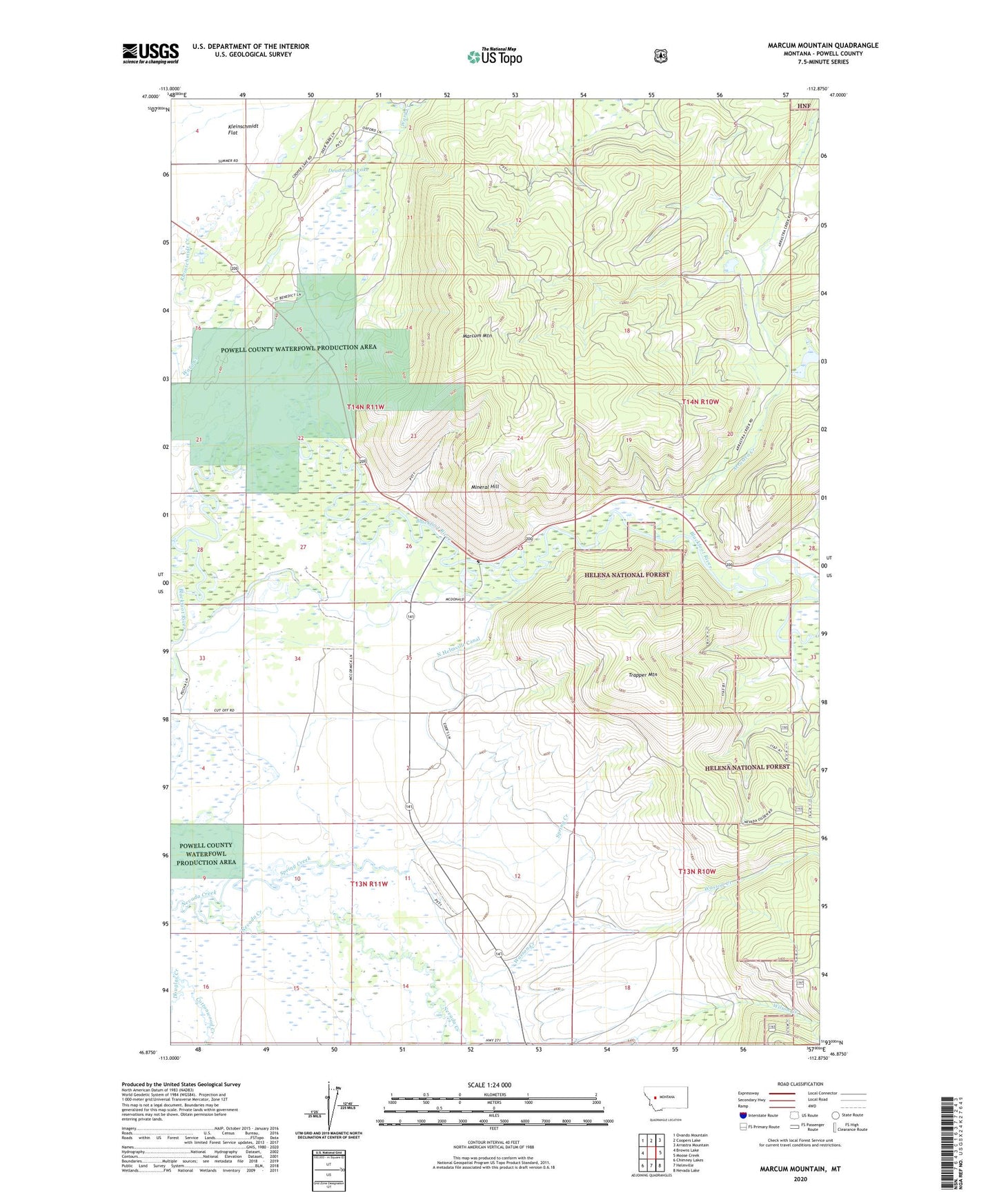
2020 topographic map quadrangle Marcum Mountain in the state of Montana. Scale: 1:24000. Based on the newly updated USGS 7.5' US Topo map series, this map is in the following counties: Powell. The map contains contour data, water features, and other items you are used to seeing on USGS maps, but also has updated roads and other features. This is the next generation of topographic maps. Printed on high-quality waterproof paper with UV fade-resistant inks.
Quads adjacent to this one:
West: Browns Lake
Northwest: Ovando Mountain
North: Coopers Lake
Northeast: Arrastra Mountain
East: Moose Creek
Southeast: Nevada Lake
South: Helmville
Southwest: Chimney Lakes
Contains the following named places: 13N11W02ADCA01 Well, 13N11W15DCDC01 Well, 14N11W16AAAD01 Well, 14N11W33BDD_01 Well, 14N11W33CDAC01 Well, 14N11W34ACCA01 Well, 14N11W35BAAA01 Well, Arrastra Creek, Copenhagen Dam, Cottonwood Creek, Coughlin, Deadmans Lake, French Town Mine, Hungry Hill Mine, Lincoln Canyon Fishing Access Site, Lincoln Slough, Marcum Mountain, Mineral Hill, Mineral Hill Sportsmans Access, Nevada Mine, North Helmville Canal, NW NE Section 17 Mine, NW SE Section 9 Mine, Powell County Waterfowl Production Area, Republican Mine, Shores Creek, Spring Creek, Steeles Dude Ranch, Trapper Mountain, Wasson Creek