MyTopo
McCloud Montana US Topo Map
Couldn't load pickup availability
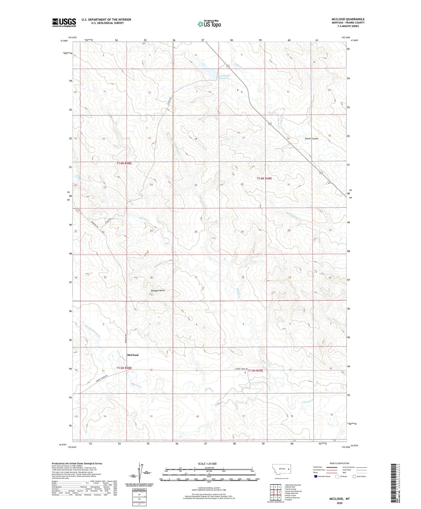
2020 topographic map quadrangle McCloud in the state of Montana. Scale: 1:24000. Based on the newly updated USGS 7.5' US Topo map series, this map is in the following counties: Prairie. The map contains contour data, water features, and other items you are used to seeing on USGS maps, but also has updated roads and other features. This is the next generation of topographic maps. Printed on high-quality waterproof paper with UV fade-resistant inks.
Quads adjacent to this one:
West: South Fork Reservoir
Northwest: Big Sheep Mountain
North: Becker Dam
Northeast: North Coulee
East: Papps Reservoir
Southeast: Calypso
South: McClure Reservoir
Southwest: Physic Creek
Contains the following named places: 13N48E01DCCD01 Well, 13N49E08DDAA01 Well, 13N49E18DBAD01 Well, 14N49E21AAAA01 Well, 14N49E28ADAC01 Well, 59349, Bowgun Butte, Hazel Post Office, Homestead Dam, Homestead Reservoir, McCloud, North Fork Cherry Creek, North Fork Plenty Creek, Plenty Creek, Schrock School, Smith Coulee, Souhrada School, Terry North Division