MyTopo
South Fork Reservoir Montana US Topo Map
Couldn't load pickup availability
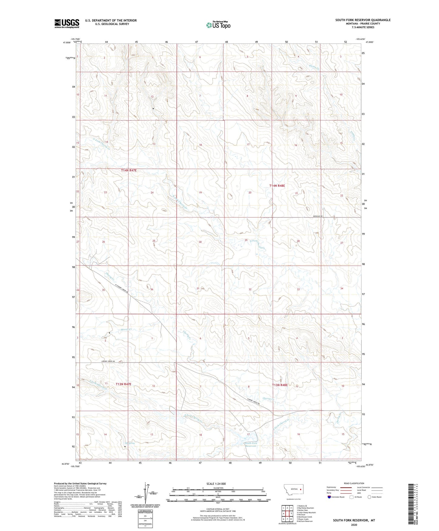
2024 topographic map quadrangle South Fork Reservoir in the state of Montana. Scale: 1:24000. Based on the newly updated USGS 7.5' US Topo map series, this map is in the following counties: Prairie. The map contains contour data, water features, and other items you are used to seeing on USGS maps, but also has updated roads and other features. This is the next generation of topographic maps. Printed on high-quality waterproof paper with UV fade-resistant inks.
Quads adjacent to this one:
West: Little Sheep Mountain
Northwest: Watkins SE
North: Big Sheep Mountain
Northeast: Becker Dam
East: McCloud
Southeast: McClure Reservoir
South: Physic Creek
Southwest: Morehouse Creek
This map covers the same area as the classic USGS quad with code o46105h6.
Contains the following named places: 13N47E02BCCC01 Well, 13N48E08DCAA01 Well, 13N48E09DABC01 Well, 14N47E13ABBA01 Well, 14N47E15DDAD01 Well, 14N47E26CDCB01 Well, 14N47E26CDCC01 Well, 14N48E05CACD01 Well, 14N48E17CDAB01 Well, 14N48E18AABD01 Well, 14N48E33ABBC01 Well, Clark Dam, Clark Reservoir, Haughian School, Highland School, McMillan Post Office, Morris Creek, Rapos School, Robertson Creek, Sig Spring, South Fork Cherry Creek, South Fork Cherry Creek Dam, South Fork Reservoir