MyTopo
Melstone NE Montana US Topo Map
Couldn't load pickup availability
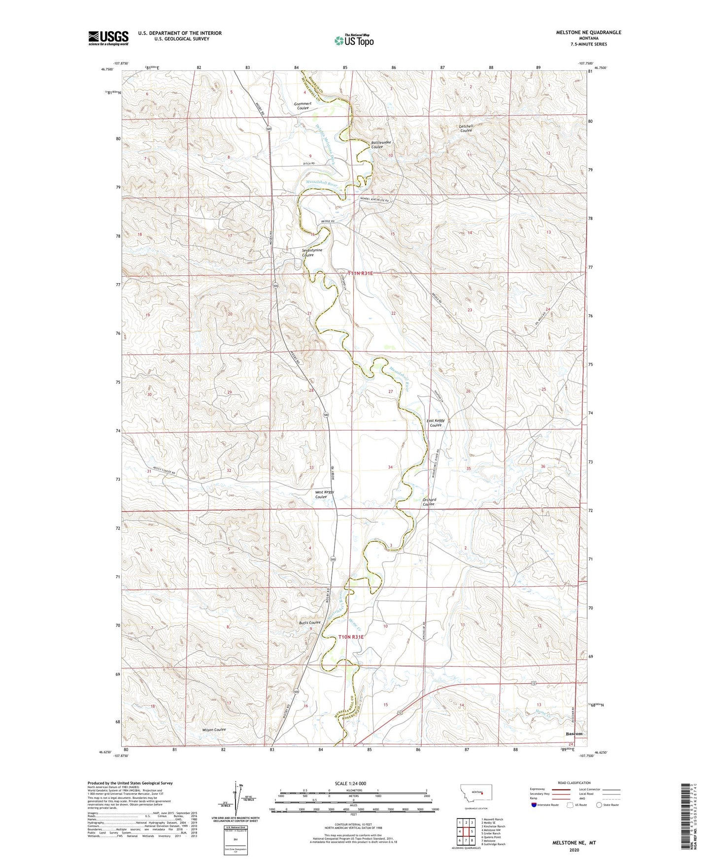
2024 topographic map quadrangle Melstone NE in the state of Montana. Scale: 1:24000. Based on the newly updated USGS 7.5' US Topo map series, this map is in the following counties: Musselshell, Rosebud. The map contains contour data, water features, and other items you are used to seeing on USGS maps, but also has updated roads and other features. This is the next generation of topographic maps. Printed on high-quality waterproof paper with UV fade-resistant inks.
Quads adjacent to this one:
West: Melstone NW
Northwest: Maxwell Ranch
North: Mosby SE
Northeast: Kincheloe Ranch
East: Grebe Ranch
Southeast: Guthridge Ranch
South: Melstone
Southwest: Queens Point
This map covers the same area as the classic USGS quad with code o46107f7.
Contains the following named places: 11N31E11DA__01 Well, 11N31E11DBD_01 Well, 11N31E34DAC_01 Well, 11N31E36AADD01 Well, Bascom, Bascom Oil Field, Bascom Post Office, Bascom School, BS Kincheloe Number 6 Dam, Butts Coulee, Butts School, Delphia Melstone Ditch, East Keggy Coulee, Getchell Coulee, Gremmert Coulee, Home Creek, Ivanhoe Dome Oil Field, Orchard Coulee, Rattlesnake Coulee, Seventynine Coulee, Stensvad Oil Field, West Keggy Coulee