MyTopo
Guthridge Ranch Montana US Topo Map
Couldn't load pickup availability
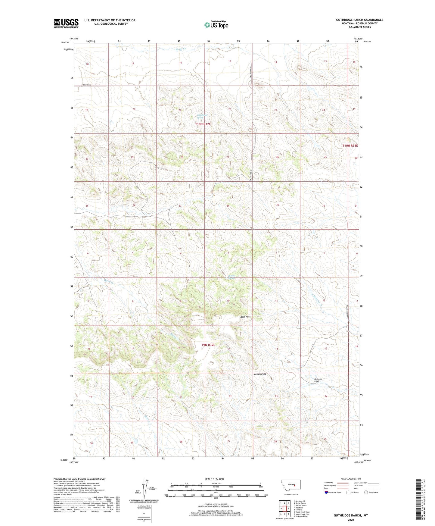
2024 topographic map quadrangle Guthridge Ranch in the state of Montana. Scale: 1:24000. Based on the newly updated USGS 7.5' US Topo map series, this map is in the following counties: Rosebud. The map contains contour data, water features, and other items you are used to seeing on USGS maps, but also has updated roads and other features. This is the next generation of topographic maps. Printed on high-quality waterproof paper with UV fade-resistant inks.
Quads adjacent to this one:
West: Melstone
Northwest: Melstone NE
North: Grebe Ranch
Northeast: Hecker Ranch
East: Sumatra
Southeast: Ruskosky Ridge
South: Weed Creek East
Southwest: Weed Creek West
This map covers the same area as the classic USGS quad with code o46107e6.
Contains the following named places: 09N32E01AAA_01 Well, 09N32E18DDDB01 Well, 10N32E26BCD_01 Well, Bar 69 Number 5 Dam, Eagle Rock, Guthridge Dam, Guthridge Ranch, Guthridge School, Hibbard, Hibbard Post Office, Hibbard School, Hildebrand Spring, Muggins Gap, Russell Spring, Stockland School, Weeks School