MyTopo
Queens Point Montana US Topo Map
Couldn't load pickup availability
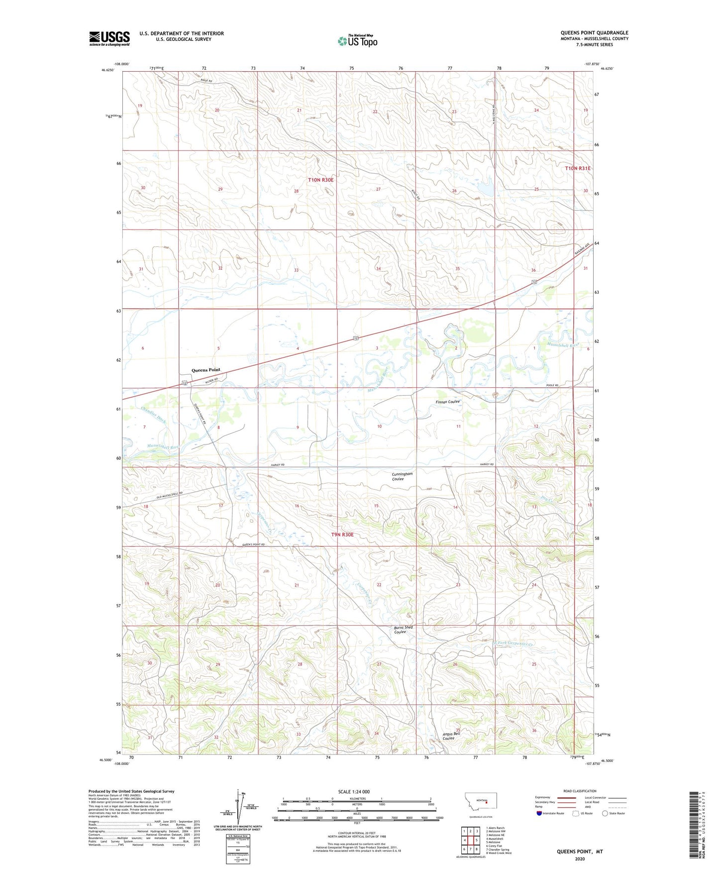
2024 topographic map quadrangle Queens Point in the state of Montana. Scale: 1:24000. Based on the newly updated USGS 7.5' US Topo map series, this map is in the following counties: Musselshell. The map contains contour data, water features, and other items you are used to seeing on USGS maps, but also has updated roads and other features. This is the next generation of topographic maps. Printed on high-quality waterproof paper with UV fade-resistant inks.
Quads adjacent to this one:
West: Musselshell
Northwest: Akers Ranch
North: Melstone NW
Northeast: Melstone NE
East: Melstone
Southeast: Weed Creek West
South: Chandler Spring
Southwest: Corey Flat
This map covers the same area as the classic USGS quad with code o46107e8.
Contains the following named places: 09N30E13CCAC01 Well, 09N30E14BDDD01 Well, 09N30E20AABA01 Well, 09N30E30DBAD01 Well, Absher, Absher Post Office, Angus Bell Coulee, Baldwin Post Office, Burnt Shed Coulee, Carpenter Creek, Carpenter Creek Post Office, Chandler Ditch, Cunningham Coulee, Dry Creek, East Fork Carpenter Creek, Finnan Coulee, Keene Mine, Melstone Dam, Queens Point