MyTopo
Miller Coulee East Montana US Topo Map
Couldn't load pickup availability
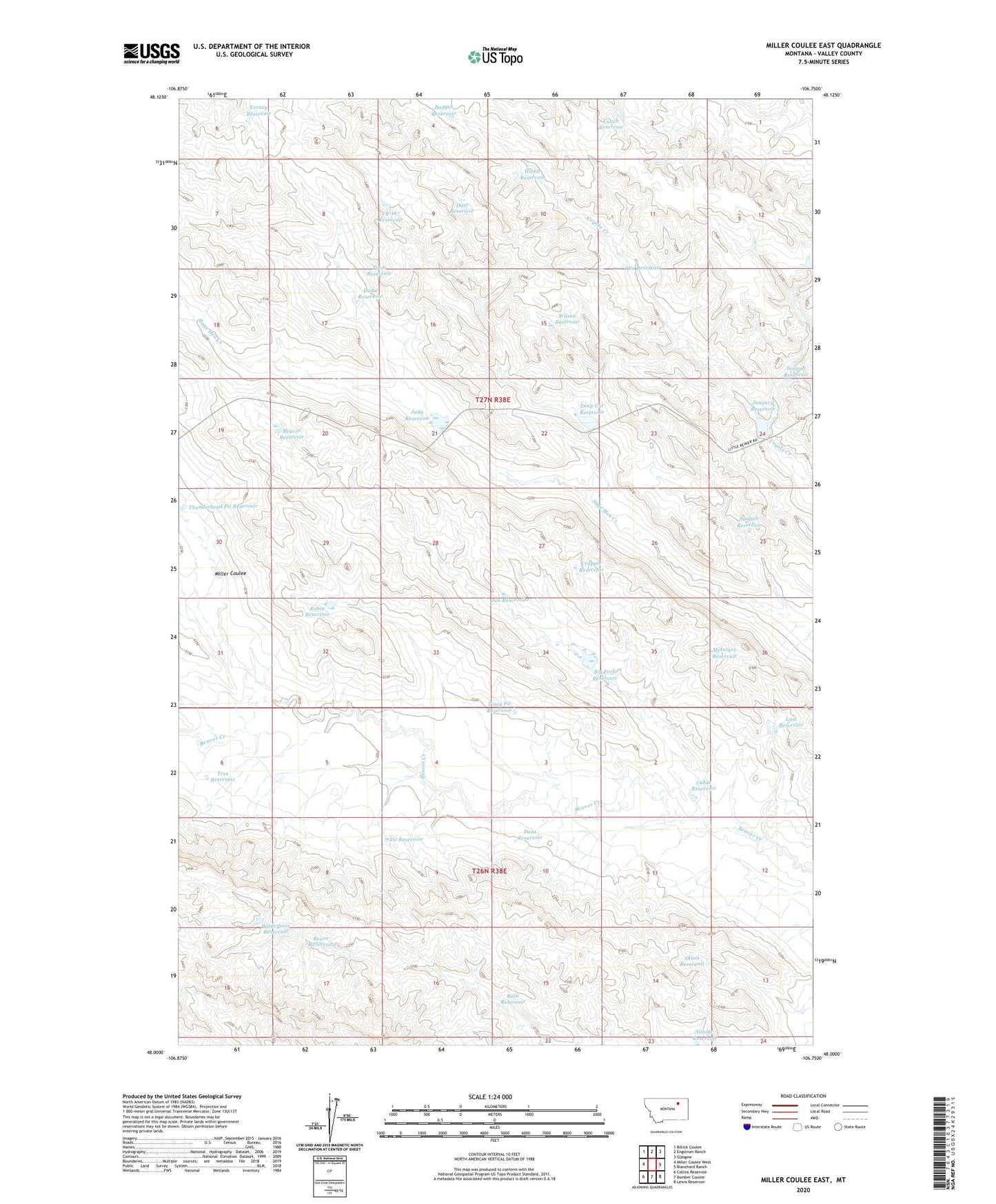
2020 topographic map quadrangle Miller Coulee East in the state of Montana. Scale: 1:24000. Based on the newly updated USGS 7.5' US Topo map series, this map is in the following counties: Valley. The map contains contour data, water features, and other items you are used to seeing on USGS maps, but also has updated roads and other features. This is the next generation of topographic maps. Printed on high-quality waterproof paper with UV fade-resistant inks.
Quads adjacent to this one:
West: Miller Coulee West
Northwest: Billick Coulee
North: Engstrom Ranch
Northeast: Glasgow
East: Blanchard Ranch
Southeast: Lewis Reservoir
South: Bomber Coulee
Southwest: Collins Reservoir
Contains the following named places: Badger Reservoir, Beaver Reservoir, Beaver Tooth Dam, Big Fork Reservoir, Big Forks Dam, Blanchard Cabin, Boone Reservoir, Cabin Reservoir, Crappie Reservoir, Deep Cut Dam, Deep Cut Reservoir, Dicks Reservoir, Do Reservoir, Dont Reservoir, Duet Reservoir, Gauge Reservoir, Gideon Ranch, Hump Reservoir, Jan Reservoir, January Dam, January Reservoir, Judy Dam, Judy Reservoir, Kerney Reservoir, Last Reservoir, Lunch Reservoir, McIntyre Reservoir, Miller Coulee, Ola Reservoir, Olson Reservoir, Rain Reservoir, Robin Reservoir, Sage Hen Reservoir, Sage Hen Reservoir Number 2 Dam, Seagull Reservoir, Sunfish Reservoir, Thunderhead Pit Reservoir, Tiney Pit Reservoir, Tree Reservoir, Trish Reservoir, VR-167 Reservoir, Wilderness Reservoir, Wilderness Reservoir Dam, Wilson Reservoir