MyTopo
Miller Coulee West Montana US Topo Map
Couldn't load pickup availability
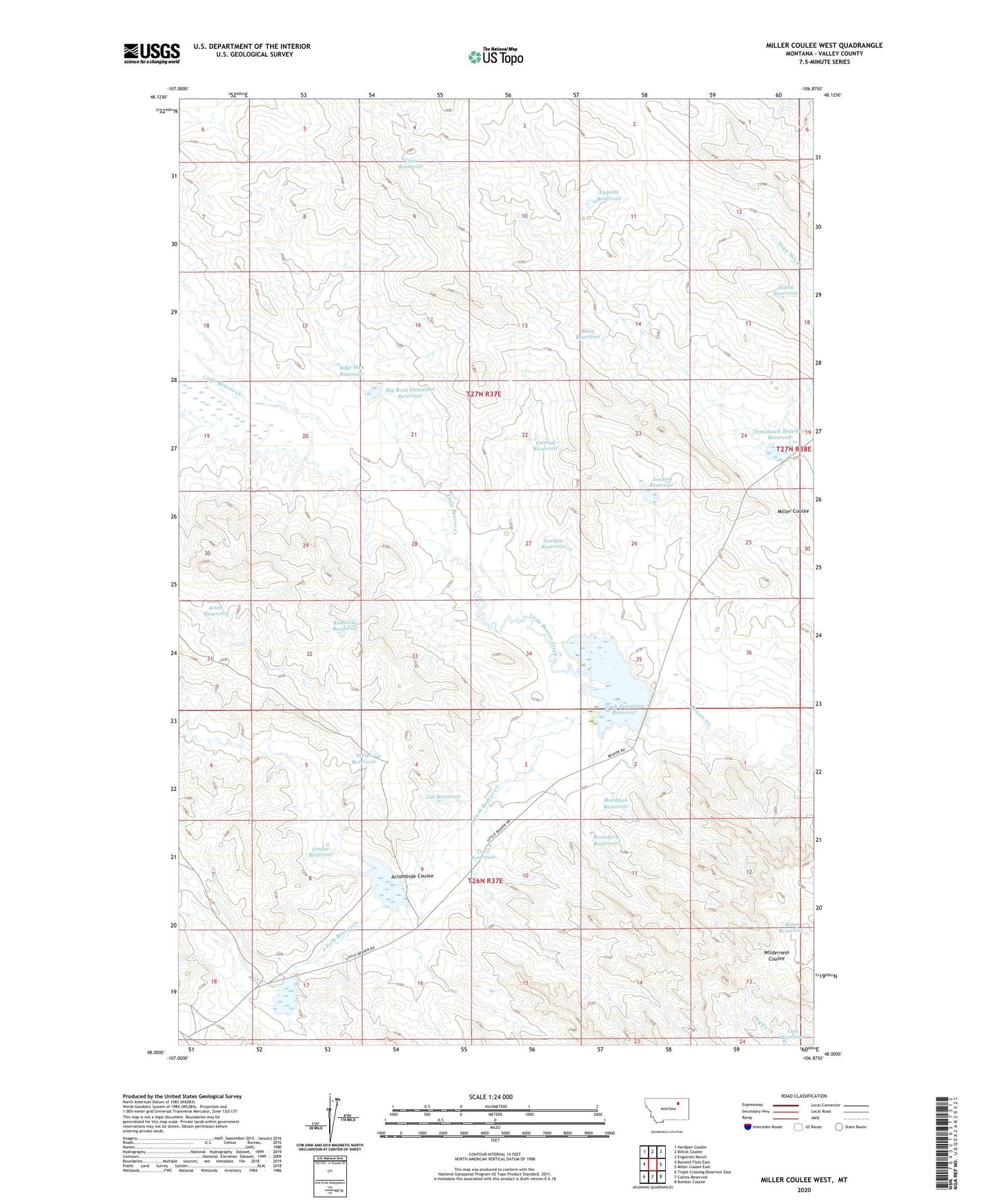
2024 topographic map quadrangle Miller Coulee West in the state of Montana. Scale: 1:24000. Based on the newly updated USGS 7.5' US Topo map series, this map is in the following counties: Valley. The map contains contour data, water features, and other items you are used to seeing on USGS maps, but also has updated roads and other features. This is the next generation of topographic maps. Printed on high-quality waterproof paper with UV fade-resistant inks.
Quads adjacent to this one:
West: Burnett Flats East
Northwest: Hardpan Coulee
North: Billick Coulee
Northeast: Engstrom Ranch
East: Miller Coulee East
Southeast: Bomber Coulee
South: Collins Reservoir
Southwest: Triple Crossing Reservoir East
This map covers the same area as the classic USGS quad with code o48106a8.
Contains the following named places: Aldrin Reservoir, Arrambide Coulee, Bean Reservoir, Beaverette Dam, Big Rock Detention Reservoir, Bliss Reservoir, Boundary Reservoir, Cat Reservoir, Cisco Reservoir, Conrad Reservoir, Coulee Reservoir, Gordon Reservoir, Grub Dam, Grub Detention Reservoir, Hardpan Reservoir, Itcaina Dam, Itcaina Reservoir, Jordan Reservoir, Kaulitski Reservoir, Knob Reservoir, Last Reservoir, Little Beaver Creek, Lonely Night Reservoir, Sage Hen Reservoir, Script Dam, Script Reservoir, South Beaver Reservoir, South Beaver Reservoir Dam, South Fork Beaver Creek, Tomahawk Dam, Tomahawk Detention Reservoir, Trail Reservoir, Uphans Reservoir