MyTopo
Lewis Reservoir Montana US Topo Map
Couldn't load pickup availability
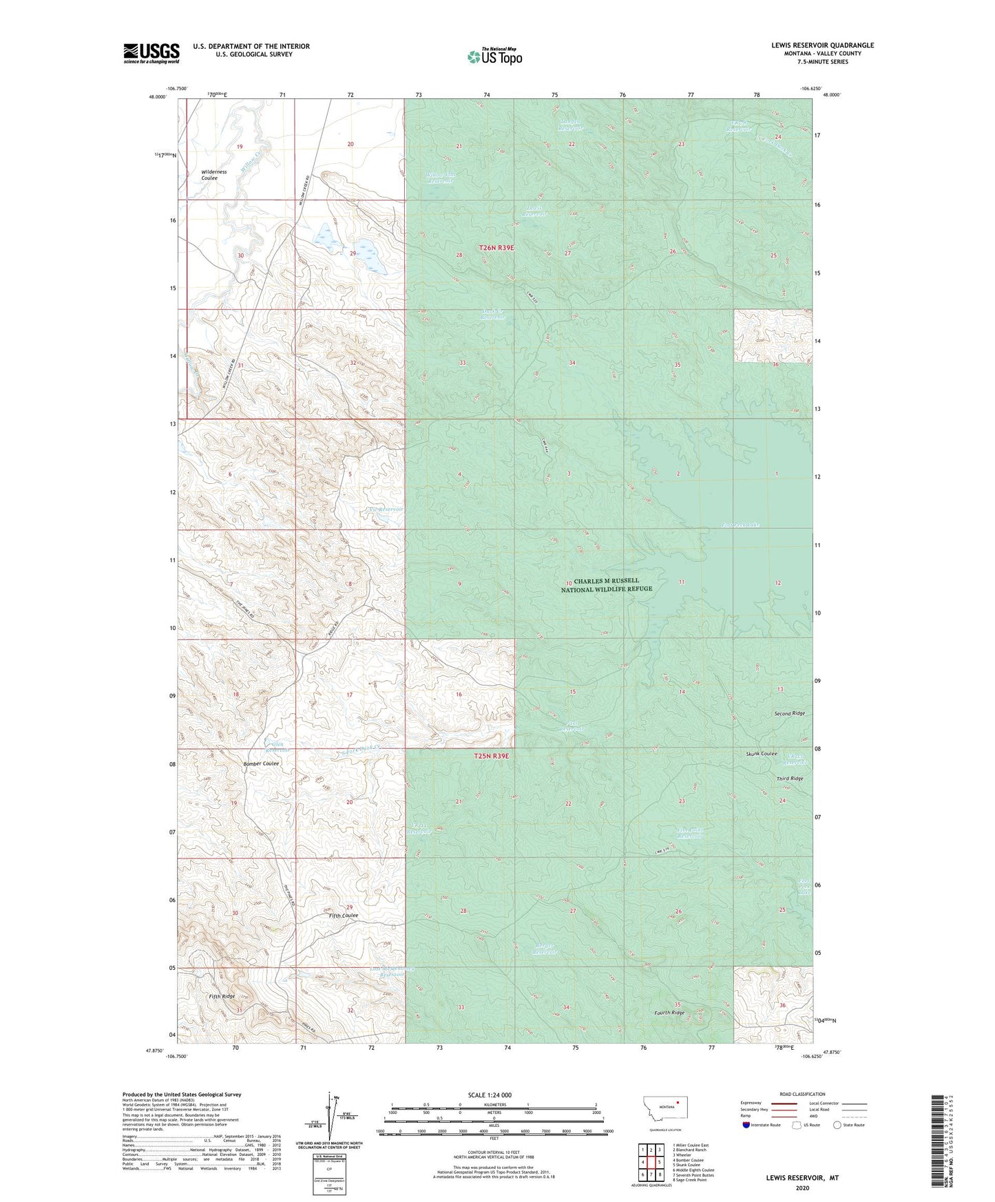
2024 topographic map quadrangle Lewis Reservoir in the state of Montana. Scale: 1:24000. Based on the newly updated USGS 7.5' US Topo map series, this map is in the following counties: Valley. The map contains contour data, water features, and other items you are used to seeing on USGS maps, but also has updated roads and other features. This is the next generation of topographic maps. Printed on high-quality waterproof paper with UV fade-resistant inks.
Quads adjacent to this one:
West: Bomber Coulee
Northwest: Miller Coulee East
North: Blanchard Ranch
Northeast: Wheeler
East: Skunk Coulee
Southeast: Sage Creek Point
South: Seventh Point Buttes
Southwest: Middle Eighth Coulee
This map covers the same area as the classic USGS quad with code o47106h6.
Contains the following named places: 25N39E08ACDC01 Well, 26N39E29ADAB01 Well, Berger Reservoir, Bob Number 1 Dam, Duck Creek Reservoir, Five Point Reservoir, Glen Reservoir, Langen Reservoir, Lewis Reservoir, Lost McMenomey Reservoir, Paul Reservoir, Paul Reservoir Dam, Third Coulee, Vic Reservoir, VR 33 Reservoir, VR 44 Reservoir, VR 78 Reservoir, Whatsitsname Dam, Wilderness Coulee, Willow Creek Flat Dam, Willow Creek Flat Reservoir, Willow Flat Diversion Dam, Willow Flat Number 2 Dam, Willow Flat Reservoir, Willow Flat Reservoir Dam