MyTopo
Hinsdale Montana US Topo Map
Couldn't load pickup availability
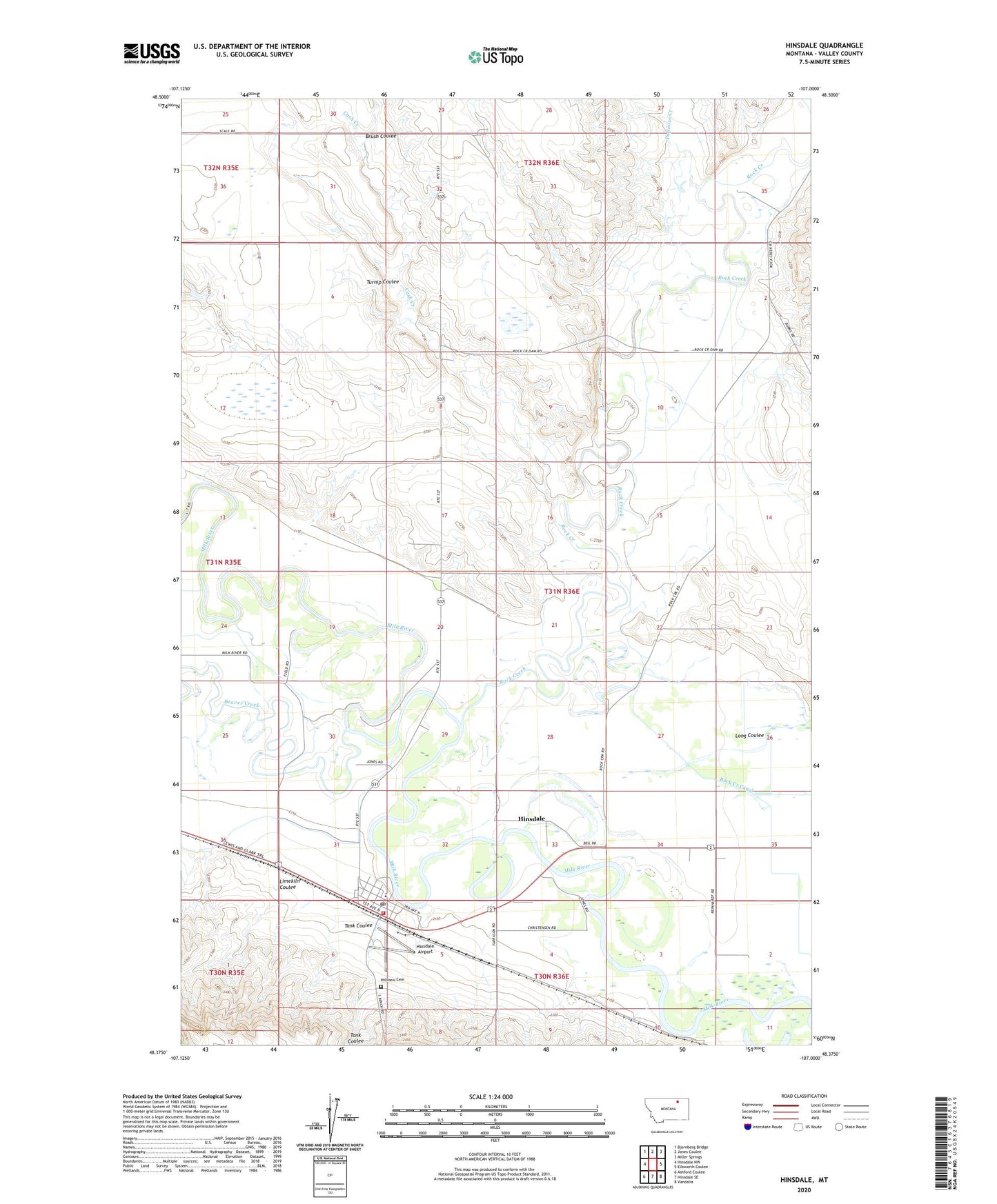
2024 topographic map quadrangle Hinsdale in the state of Montana. Scale: 1:24000. Based on the newly updated USGS 7.5' US Topo map series, this map is in the following counties: Valley. The map contains contour data, water features, and other items you are used to seeing on USGS maps, but also has updated roads and other features. This is the next generation of topographic maps. Printed on high-quality waterproof paper with UV fade-resistant inks.
Quads adjacent to this one:
West: Hinsdale NW
Northwest: Bjornberg Bridge
North: Jones Coulee
Northeast: Miller Springs
East: Ellsworth Coulee
Southeast: Vandalia
South: Hinsdale SE
Southwest: Ashford Coulee
This map covers the same area as the classic USGS quad with code o48107d1.
Contains the following named places: 31N35E36BD__01 Well, 59241, Baalke Slough, Beaver Creek, Brush Coulee, Cash Creek, Grace Baptist Church, Happy Flat School, Harvest States Cooperatives Elevator, Hillview Cemetery, Hinsdale, Hinsdale Airport, Hinsdale Census Designated Place, Hinsdale Lutheran Church, Hinsdale Post Office, Hinsdale School, Hinsdale Volunteer Fire Department, Hulbert's Ranch, Limekiln Coulee, Papoose Creek, Rock Creek, Rock Creek Canal, Rock Creek Schoolhouse, Roub's Ranch, Saint Alberts Catholic Church, Saint Anthony and Dakota Elevator, Sherry's Ranch, Tank Coulee, Turnip Coulee, United Methodist Church, Whitmore's Ranch, Wooldridge's Ranch