MyTopo
Mission Coulee Montana US Topo Map
Couldn't load pickup availability
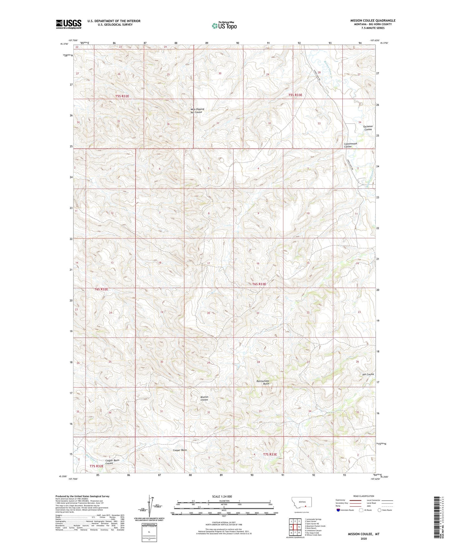
2020 topographic map quadrangle Mission Coulee in the state of Montana. Scale: 1:24000. Based on the newly updated USGS 7.5' US Topo map series, this map is in the following counties: Big Horn. The map contains contour data, water features, and other items you are used to seeing on USGS maps, but also has updated roads and other features. This is the next generation of topographic maps. Printed on high-quality waterproof paper with UV fade-resistant inks.
Quads adjacent to this one:
West: Mountain Pocket Creek
Northwest: Lemonade Springs
North: Saint Xavier
Northeast: Saint Xavier NE
East: Shick Ranch
Southeast: Willow Creek Dam
South: Dry Soap Creek
Southwest: Limestone Canyon
Contains the following named places: Cooper Basin, Cooper Basin Coulee, Cottonwood Coulee, Crow Reservation Division, Eychaner Coulee, Rattlesnake Butte, Siemion Ranch