MyTopo
Lemonade Springs Montana US Topo Map
Couldn't load pickup availability
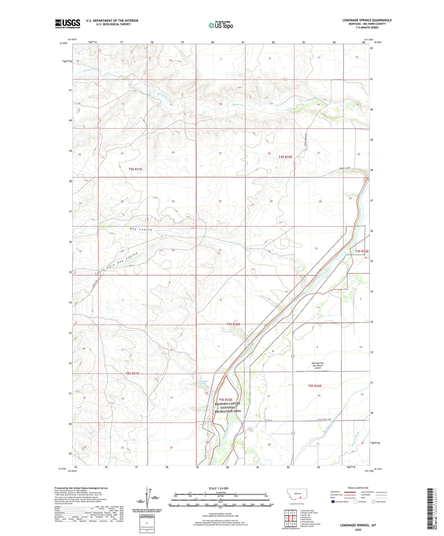
2024 topographic map quadrangle Lemonade Springs in the state of Montana. Scale: 1:24000. Based on the newly updated USGS 7.5' US Topo map series, this map is in the following counties: Big Horn. The map contains contour data, water features, and other items you are used to seeing on USGS maps, but also has updated roads and other features. This is the next generation of topographic maps. Printed on high-quality waterproof paper with UV fade-resistant inks.
Quads adjacent to this one:
West: Camp Four
Northwest: Bentonite Flats
North: Woody Creek Camp
Northeast: Hardin SW
East: Saint Xavier
Southeast: Mission Coulee
South: Mountain Pocket Creek
Southwest: Yellowtail Dam
This map covers the same area as the classic USGS quad with code o45107d7.
Contains the following named places: 05S32E20BAA_01 Well, Bighorn Fishing Access Site, Camp Five School, Hay Coulee, Lemonade Springs, Pale Morning Dun Ranch Airport, Soap Creek, South Fork Hay Coulee