MyTopo
Mountain Pocket Creek Montana US Topo Map
Couldn't load pickup availability
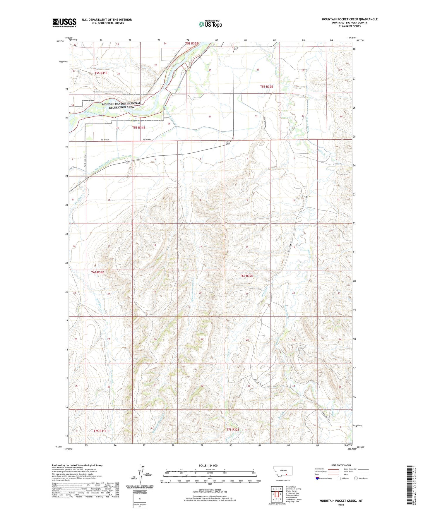
2024 topographic map quadrangle Mountain Pocket Creek in the state of Montana. Scale: 1:24000. Based on the newly updated USGS 7.5' US Topo map series, this map is in the following counties: Big Horn. The map contains contour data, water features, and other items you are used to seeing on USGS maps, but also has updated roads and other features. This is the next generation of topographic maps. Printed on high-quality waterproof paper with UV fade-resistant inks.
Quads adjacent to this one:
West: Yellowtail Dam
Northwest: Camp Four
North: Lemonade Springs
Northeast: Saint Xavier
East: Mission Coulee
Southeast: Dry Soap Creek
South: Limestone Canyon
Southwest: Peyote Point
This map covers the same area as the classic USGS quad with code o45107c7.
Contains the following named places: 05S31E35CCC_02 Well, 05S31E36DBB_01 Well, 06S32E27CD__01 Well, 06S32E34ACC_01 Well, 07S32E02BB__01 Well, Deer Creek, Dry Soap Creek, Krone Ditch, Mountain Pocket Creek, Soap Creek Oilfield, South Fork West Soap Creek, War Man Creek, Warman School, West Soap Creek, Wolf Ranch