MyTopo
Mizpah Montana US Topo Map
Couldn't load pickup availability
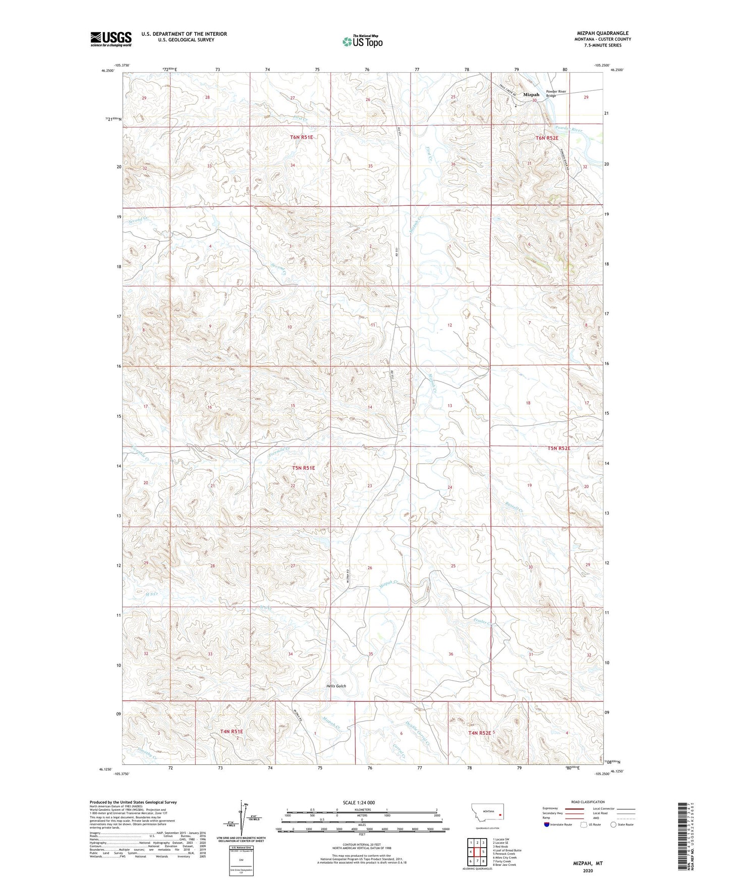
2024 topographic map quadrangle Mizpah in the state of Montana. Scale: 1:24000. Based on the newly updated USGS 7.5' US Topo map series, this map is in the following counties: Custer. The map contains contour data, water features, and other items you are used to seeing on USGS maps, but also has updated roads and other features. This is the next generation of topographic maps. Printed on high-quality waterproof paper with UV fade-resistant inks.
Quads adjacent to this one:
West: Loaf of Bread Butte
Northwest: Locate SW
North: Locate SE
Northeast: Red Knob
East: Pennock Creek
Southeast: Bear Jaw Creek
South: Forty Creek
Southwest: Miles City Creek
This map covers the same area as the classic USGS quad with code o46105b3.
Contains the following named places: 04N53E04BCB_01 Well, 05N51E01CDBD01 Well, 05N51E12BC__01 Well, 05N51E29DDDC01 Well, 05N52E18BBBB01 Well, 05N52E20BCCC01 Well, 05N52E30AD__01 Well, 06N52E29CCDD01 Well, 06N52E30ADCB01 Well, 06N52E30ADCC01 Well, 06N52E30CD__01 Well, Balsam Ranch, Corral Creek, Double Corral Creek, Fessler Creek, First Creek, Fivemile Creek, Hells Gulch, J Hardy Number 1 Dam, J Hardy Number 2 Dam, M S Creek, Mizpah, Mizpah Post Office, Powder River Bridge, Riverview School, Russell Creek, Second Creek