MyTopo
Forty Creek Montana US Topo Map
Couldn't load pickup availability
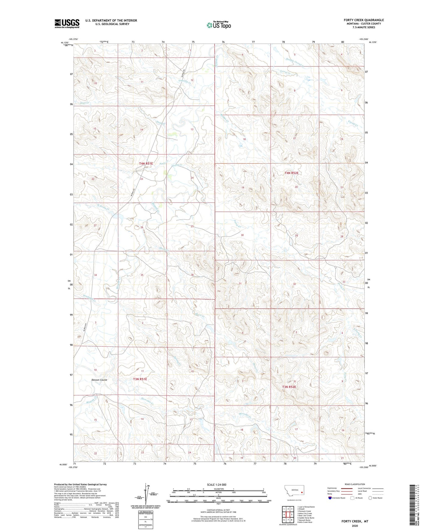
2024 topographic map quadrangle Forty Creek in the state of Montana. Scale: 1:24000. Based on the newly updated USGS 7.5' US Topo map series, this map is in the following counties: Custer. The map contains contour data, water features, and other items you are used to seeing on USGS maps, but also has updated roads and other features. This is the next generation of topographic maps. Printed on high-quality waterproof paper with UV fade-resistant inks.
Quads adjacent to this one:
West: Miles City Creek
Northwest: Loaf of Bread Butte
North: Mizpah
Northeast: Pennock Creek
East: Bear Jaw Creek
Southeast: Mills Creek West
South: Maxwell Butte
Southwest: Saddle Horse Butte
This map covers the same area as the classic USGS quad with code o46105a3.
Contains the following named places: 03N51E01DAAA01 Well, 03N52E17DCBC01 Well, 04N51E15DCCC01 Well, 04N52E30BDAC01 Well, Balsam Number 1 Dam, Bridge Creek, Dawson Coulee, Doat Creek, East Forty Creek, Forty Creek, Hercules Creek, Maxwell Post Office, Mizpah School, Pinto Creek, Robinson Number 4 Dam, Robinson Number 6 Dam, Robinson Number 7 Dam, Robinson Number 8 Dam, Robinson Number 9 Dam, Short Creek, Spring Creek, Timothy Creek, Todd Number 1 Dam, West Forty Creek, Windmill Creek