MyTopo
Moccasin Montana US Topo Map
Couldn't load pickup availability
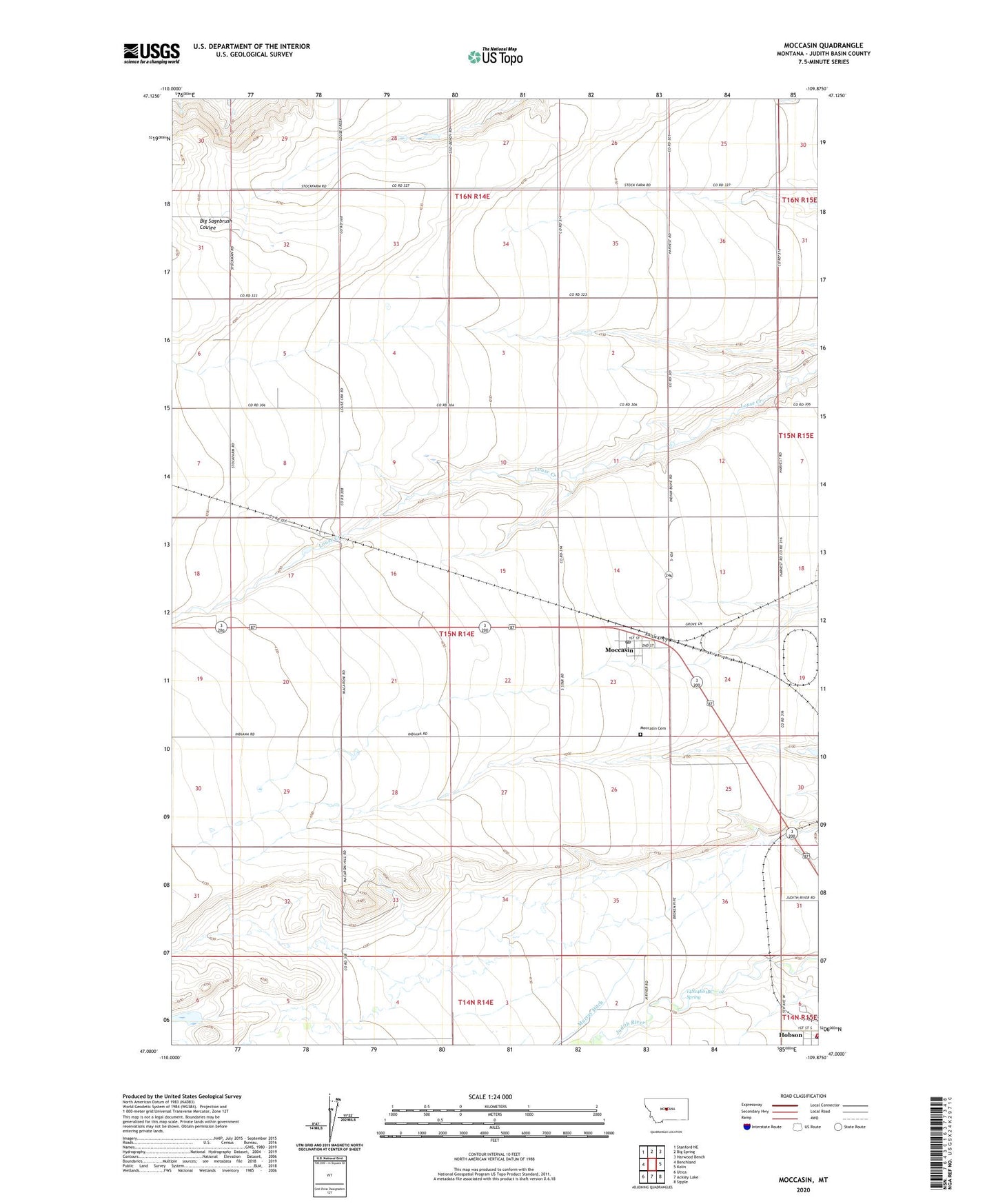
2024 topographic map quadrangle Moccasin in the state of Montana. Scale: 1:24000. Based on the newly updated USGS 7.5' US Topo map series, this map is in the following counties: Judith Basin. The map contains contour data, water features, and other items you are used to seeing on USGS maps, but also has updated roads and other features. This is the next generation of topographic maps. Printed on high-quality waterproof paper with UV fade-resistant inks.
Quads adjacent to this one:
West: Benchland
Northwest: Stanford NE
North: Big Spring
Northeast: Harwood Bench
East: Kolin
Southeast: Sipple
South: Ackley Lake
Southwest: Utica
This map covers the same area as the classic USGS quad with code o47109a8.
Contains the following named places: 14N14E01BC__01 Spring, 14N14E01DA__01 Well, 14N14E01DA__02 Well, 14N14E06ADD_01 Well, 14N14E06DB__01 Well, 15N14E12BCC_01 Well, 15N14E16DCDD01 Well, 15N14E23ACA_01 Well, 15N14E34DD__01 Well, 59462, Atlas Dam, General Mills Incorporated Elevator, Hobson Post Office, Hobson Rural Volunteer Fire District, Moccasin, Moccasin Cemetery, Moccasin Census Designated Place, Moccasin Post Office, Moccasin School, Murray Ditch