MyTopo
Harwood Bench Montana US Topo Map
Couldn't load pickup availability
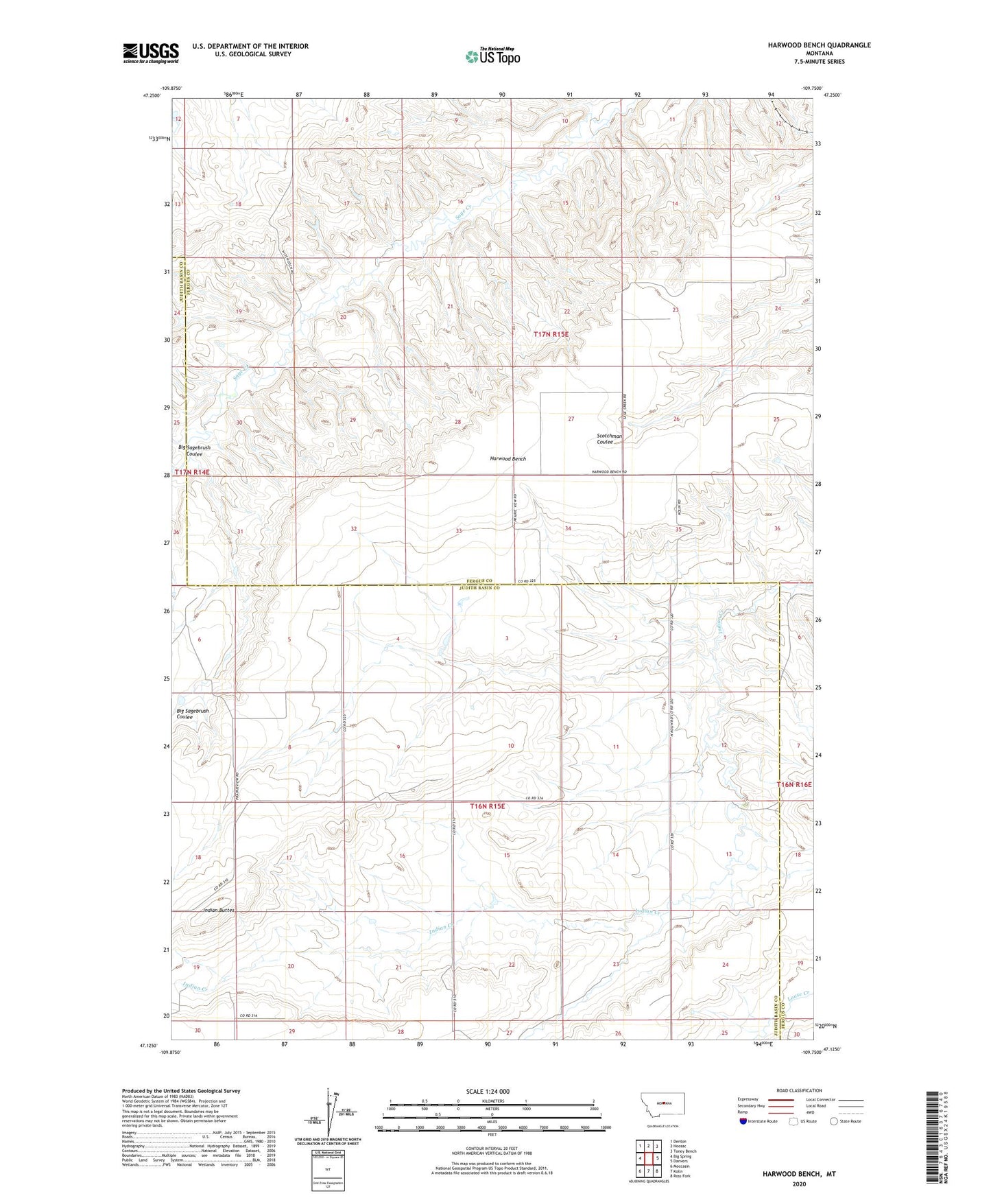
2024 topographic map quadrangle Harwood Bench in the state of Montana. Scale: 1:24000. Based on the newly updated USGS 7.5' US Topo map series, this map is in the following counties: Fergus, Judith Basin. The map contains contour data, water features, and other items you are used to seeing on USGS maps, but also has updated roads and other features. This is the next generation of topographic maps. Printed on high-quality waterproof paper with UV fade-resistant inks.
Quads adjacent to this one:
West: Big Spring
Northwest: Denton
North: Hoosac
Northeast: Toney Bench
East: Danvers
Southeast: Ross Fork
South: Kolin
Southwest: Moccasin
This map covers the same area as the classic USGS quad with code o47109b7.
Contains the following named places: 16N15E12CBD_01 Well, 16N15E13BAB_01 Well, 16N15E15CCC_01 Well, 16N15E30AB__01 Well, 17N15E19DADB01 Well, 17N15E27BCA_01 Well, 17N15E27CCC_01 Well, 17N15E27DC__01 Well, 17N15E34BDCC01 Well, Big Sagebrush Coulee, Harwood Bench, Indian Buttes, Prairie View School