
MyTopo
Molt Montana US Topo Map
Couldn't load pickup availability
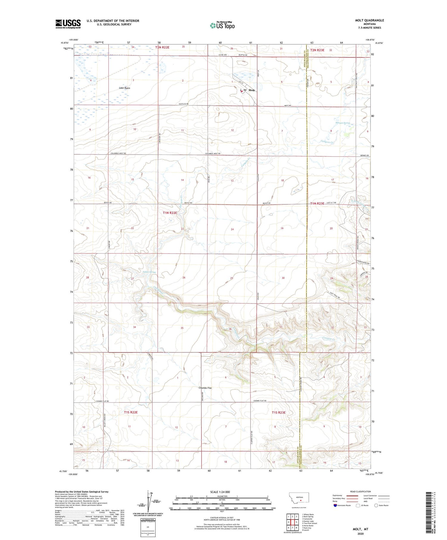
2020 topographic map quadrangle Molt in the state of Montana. Scale: 1:24000. Based on the newly updated USGS 7.5' US Topo map series, this map is in the following counties: Stillwater, Yellowstone. The map contains contour data, water features, and other items you are used to seeing on USGS maps, but also has updated roads and other features. This is the next generation of topographic maps. Printed on high-quality waterproof paper with UV fade-resistant inks.
Quads adjacent to this one:
West: Hunter Lake
Northwest: Wheat Basin
North: Rock Spring
Northeast: Comanche
East: Two Pine School
Southeast: Laurel
South: Park City
Southwest: Horse Butte
Contains the following named places: 01N22E02BCBC01 Well, 01N22E02CDCA01 Well, 01N22E02CDCD01 Well, 01N22E10DCCD01 Well, 01N22E11CCCC01 Well, 01N22E14BCCC01 Well, 01N22E14CDAB01 Well, 01N22E15ABBB01 Well, 01N23E08ACCA01 Well, 01S22E12AAAA01 Well, 59057, Coombs, Coombs Flat, Indian Spring, Lazy K T Ranch, Luckey Homestead, Molt, Molt Post Office, Molt School, Molt Volunteer Fire Department, Morgan Spring, Thurza Post Office


