MyTopo
Two Pine School Montana US Topo Map
Couldn't load pickup availability
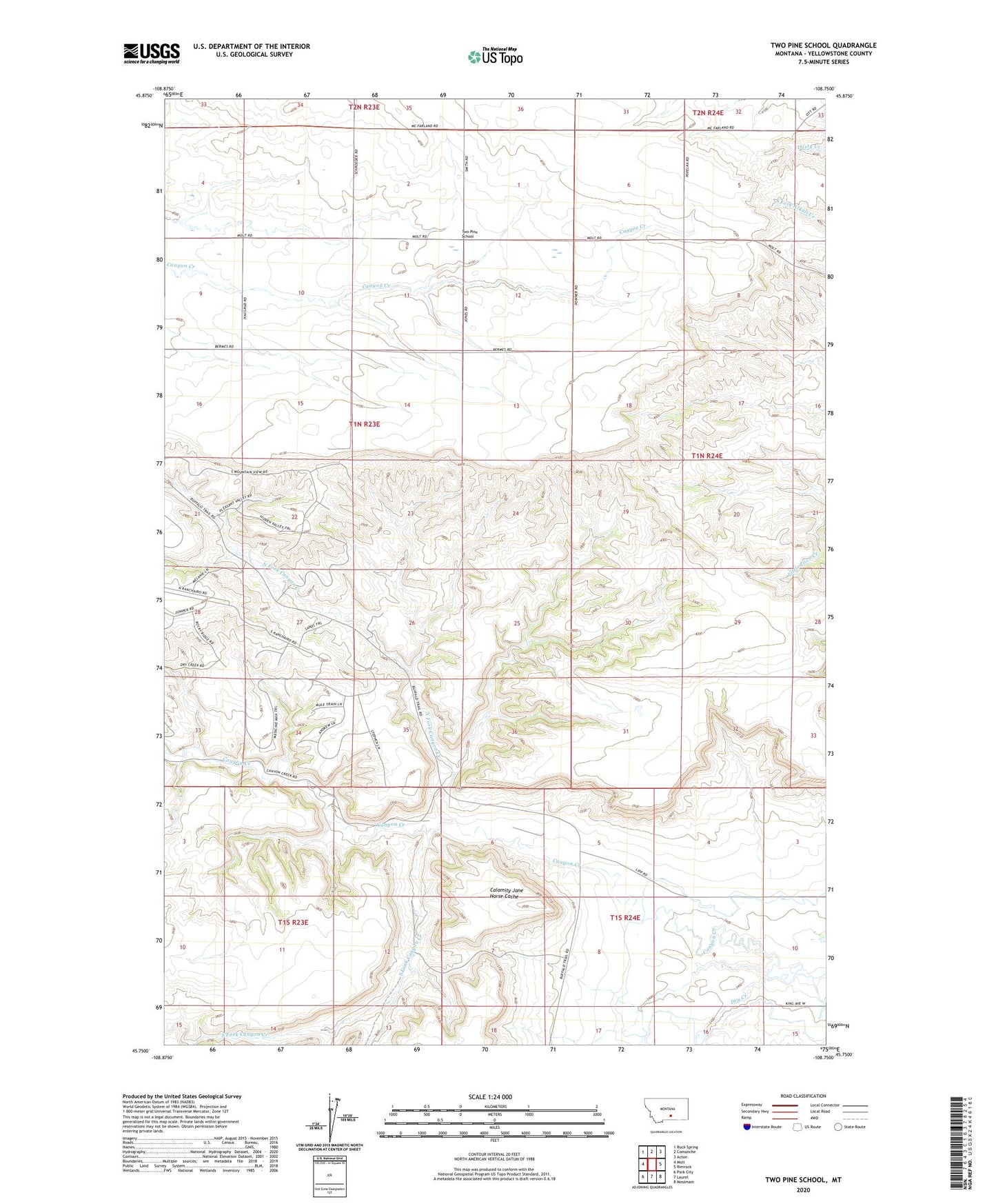
2024 topographic map quadrangle Two Pine School in the state of Montana. Scale: 1:24000. Based on the newly updated USGS 7.5' US Topo map series, this map is in the following counties: Yellowstone. The map contains contour data, water features, and other items you are used to seeing on USGS maps, but also has updated roads and other features. This is the next generation of topographic maps. Printed on high-quality waterproof paper with UV fade-resistant inks.
Quads adjacent to this one:
West: Molt
Northwest: Rock Spring
North: Comanche
Northeast: Acton
East: Rimrock
Southeast: Mossmain
South: Laurel
Southwest: Park City
This map covers the same area as the classic USGS quad with code o45108g7.
Contains the following named places: 01N23E12A___01 Well, 01N23E35DDBD01 Well, 01S24E10BDAA01 Well, Calamity Jane Horse Cache, Dry Creek, F Downs Number 1 Dam, North Fork Canyon Creek, South Fork Canyon Creek, Two Pine School