MyTopo
Park City Montana US Topo Map
Couldn't load pickup availability
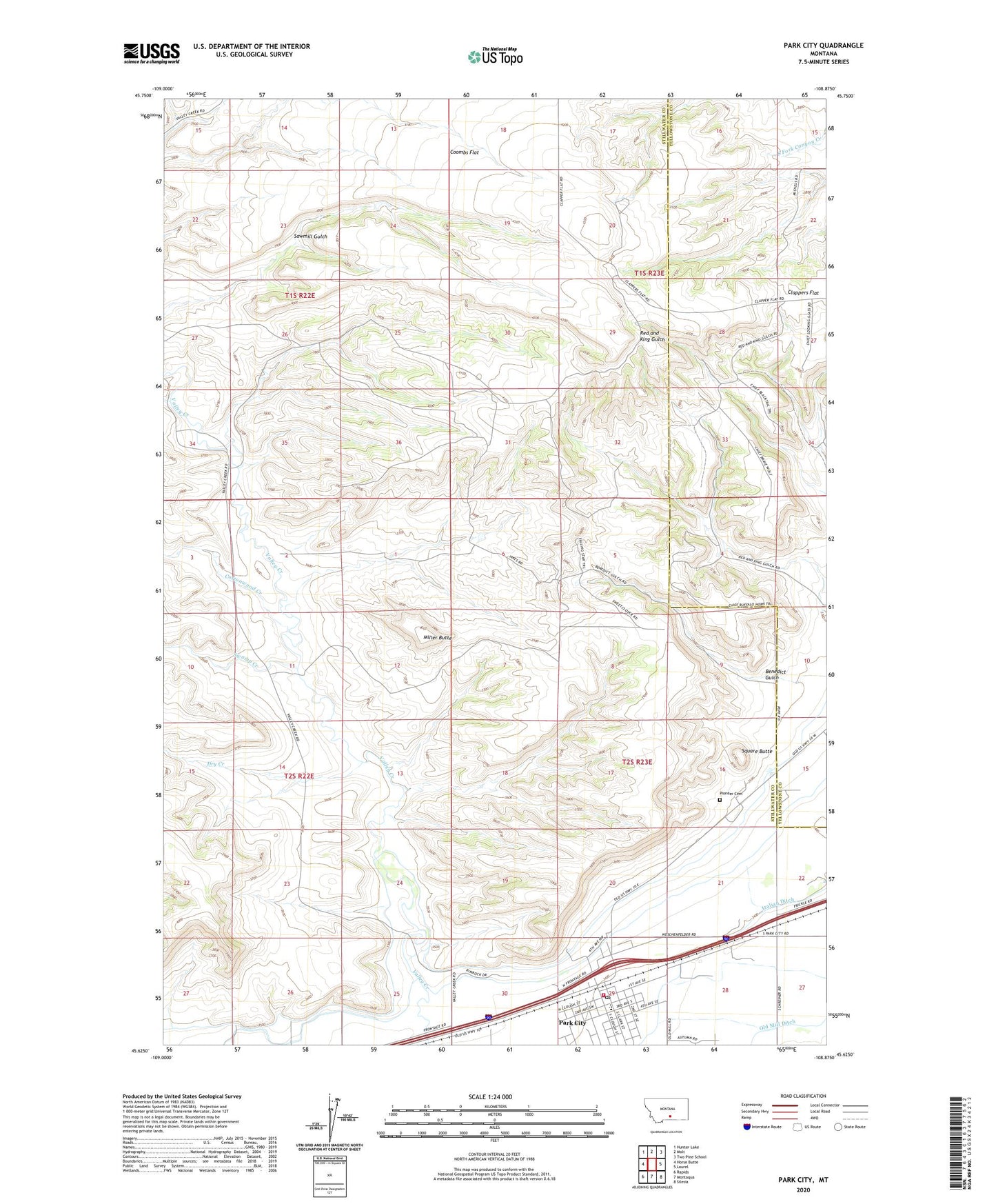
2024 topographic map quadrangle Park City in the state of Montana. Scale: 1:24000. Based on the newly updated USGS 7.5' US Topo map series, this map is in the following counties: Stillwater, Yellowstone. The map contains contour data, water features, and other items you are used to seeing on USGS maps, but also has updated roads and other features. This is the next generation of topographic maps. Printed on high-quality waterproof paper with UV fade-resistant inks.
Quads adjacent to this one:
West: Horse Butte
Northwest: Hunter Lake
North: Molt
Northeast: Two Pine School
East: Laurel
Southeast: Silesia
South: Montaqua
Southwest: Rapids
This map covers the same area as the classic USGS quad with code o45108f8.
Contains the following named places: 01S22E14CBBB01 Well, 02S23E09BBAC01 Well, 02S23E10CDDB01 Well, 02S23E15CDBB01 Well, 02S23E16DADD01 Well, 02S23E20ADDC01 Well, 02S23E21CCCC01 Well, 02S23E27BABB01 Well, 02S23E28CBBC01 Well, 02S23E29BDAC01 Well, 02S23E29BDAD01 Well, 02S23E30CCCC01 Well, 59063, Benedict Gulch, Cottonwood Creek, Dry Creek, Indian Gulch, Italian Ditch, Miller Butte, Old Mill Ditch, Park City, Park City Ambulance, Park City Baptist Church, Park City Catholic Church, Park City Census Designated Place, Park City Methodist Church, Park City Post Office, Park City Rural Fire District - Park City Volunteer Fire Department, Park City School, Pioneer Cemetery, Saint Paul Lutheran Church, Sawmill Gulch, Square Butte, Swamp Creek