MyTopo
Horse Butte Montana US Topo Map
Couldn't load pickup availability
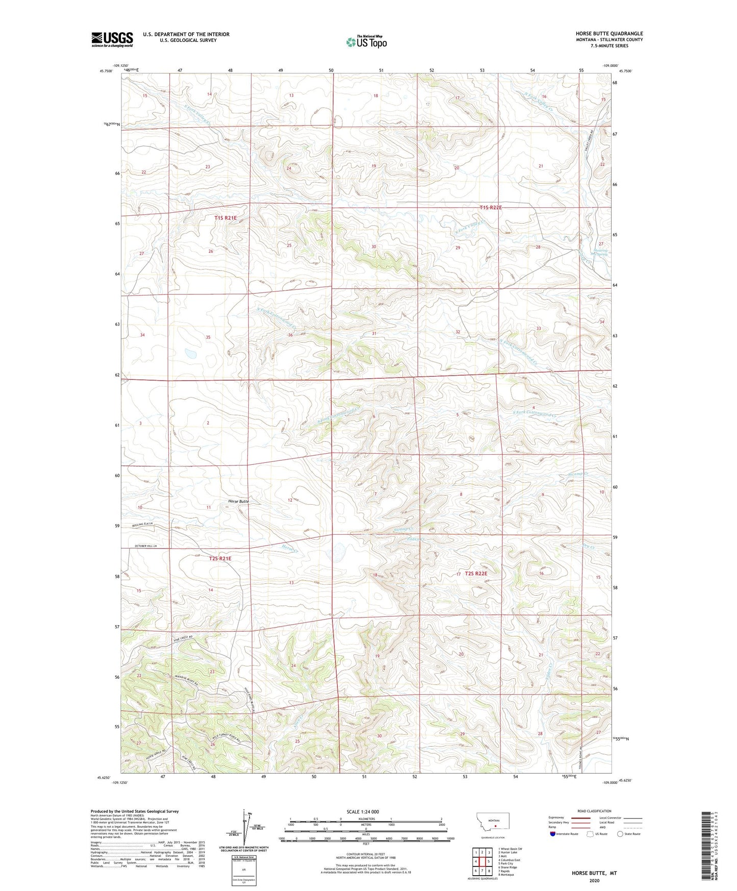
2024 topographic map quadrangle Horse Butte in the state of Montana. Scale: 1:24000. Based on the newly updated USGS 7.5' US Topo map series, this map is in the following counties: Stillwater. The map contains contour data, water features, and other items you are used to seeing on USGS maps, but also has updated roads and other features. This is the next generation of topographic maps. Printed on high-quality waterproof paper with UV fade-resistant inks.
Quads adjacent to this one:
West: Columbus East
Northwest: Wheat Basin SW
North: Hunter Lake
Northeast: Molt
East: Park City
Southeast: Montaqua
South: Rapids
Southwest: Shane Ridge
This map covers the same area as the classic USGS quad with code o45109f1.
Contains the following named places: 01S21E34BDDD01 Well, Horse Butte, North Fork Cottonwood Creek, North Fork Valley Creek, Park City Division, Shearing Pen Spring, South Fork Cottonwood Creek, South Fork Valley Creek