MyTopo
Montague Butte Montana US Topo Map
Couldn't load pickup availability
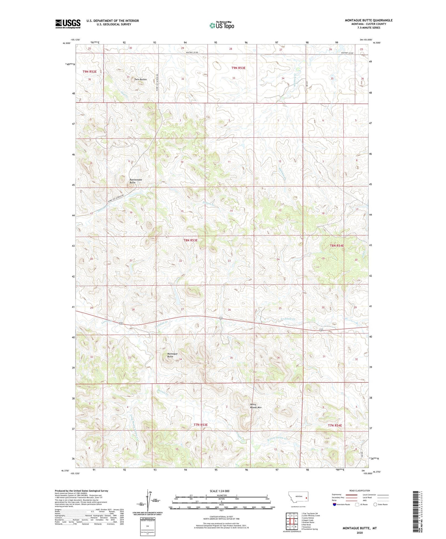
2020 topographic map quadrangle Montague Butte in the state of Montana. Scale: 1:24000. Based on the newly updated USGS 7.5' US Topo map series, this map is in the following counties: Custer. The map contains contour data, water features, and other items you are used to seeing on USGS maps, but also has updated roads and other features. This is the next generation of topographic maps. Printed on high-quality waterproof paper with UV fade-resistant inks.
Quads adjacent to this one:
West: Hogan Creek
Northwest: Flat Top Butte SW
North: Little Whitney Creek
Northeast: Loony Hollow
East: Bracket Butte
Southeast: Foundation Spring
South: Knowlton
Southwest: Red Knob
Contains the following named places: 07N53E04AD__01 Well, 07N54E08CA__01 Well, 08N53E15ADDA01 Well, 08N53E23CD__01 Well, 08N53E24BA__01 Well, 08N53E27DABC01 Well, 08N54E08AC__01 Well, 08N54E30DB__01 Well, 08N55E33AABA02 Well, 09N53E29CC__01 Well, After the Roundup Historical Marker, Archdale Creek, Ford Post Office, Henry Woods Mountain, Leland Number 1 Dam, Locate Rest Area, Long Prong Locate Creek, Montague Butte, North Fork Locate Creek, Rattlesnake Butte, Twin Buttes